Wales
 Stadsplattegrond - Wegenkaart - landkaart Cardiff & Wales | ITMB
Een dubbelzijdige kaart met aan de ene zijde een plattegrond van Cardiff, schaal 1:8.000 en op de andere zijde een wegenkaart, schaal 1:300.000, met aanduidingen van o.a. nationale parken, vliegveld, …
 Wandelgids Park Rangers Favourite Walks Snowdonia | Collins
Compacte wandelgids met 20 wandelingen geselecteerd door park rangers en met duidelijke beschrijvingen en routekaartjes. Walking guide to the Snowdonia National Park, with 20 best routes chosen by the …
 Wegenkaart - landkaart National Park Pocket Map Snowdonia | Collins
Duidelijke pocket wandelkaart met belangrijke toeristische informatie, bezienswaardigheden, campeerplekken e.d. Handy little full colour map and guide of Snowdonia National Park. Detailed mapping and visitor information to the National …
 Wegenkaart - landkaart National Park Pocket Map Pembrokeshire Coast | Collins
Duidelijke pocket wandelkaart met belangrijke toeristische informatie, bezienswaardigheden, campeerplekken e.d. Handy little full colour map and guide of Pembrokeshire Coast National Park. Detailed mapping and visitor information to the National …
★★★★★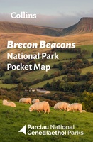 Wegenkaart - landkaart National Park Pocket Map Brecon Beacons | Collins
Handige kleine kaart van dit Nationaal Park. De kaart geeft een goed en helder overzicht van het gebied met alle plaatsen, doorgaande wandelpaden (alhoewel grof van schaal), bezienswaardigheden etc. Met …
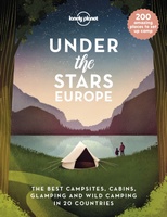 Reisinspiratieboek Under the Stars - Europe | Lonely Planet
From wild camping to curling up in a cabin, discover 200 amazing places to sleep under the stars in Europe. Lonely Planet's experts have scoured the continent to recommend the …
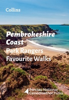 Wandelgids Park Rangers Favourite Walks Pembrokeshire Coast | Collins
The perfect companions for exploring the National Parks. Walking guide to the Pembrokeshire Coast National Park, with 20 best routes chosen by the park rangers. Each walk varies in length …
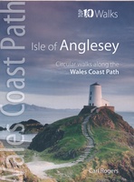 Wandelgids Isle of Anglesey - Wales | Northern Eye Books
Zeer handzaam boekje van een tiental rondwandelingen, met goede kaarten en beschrijving. Leuke toevoeging op de route of als je alleen maar naar die streek gaat en op zoek bent …
 Fietsgids Cycling Lon Las Cymru | Cicerone
Guidebook to cycling Lôn Las Cymru, a 255 mile (410km) route from Cardiff, or 242 mile (390km) from Chepstow to Holyhead, showcasing Wales's beautiful rural heartland. Passing through the Brecon …
 Wandelgids 100 outstanding British Walks | Ordnance Survey
Beschrijving van de 100 mooiste Pathfinder wandelingen in Engeland, Wales en Schotland. Uitstekende beschrijving van de route met een zeer duidelijke topografische kaart waarop de route is ingetekend. This magnificent …
 Campinggids Wild Camping UK and Ireland | Conway
Als je echt op zoek bent naar bijzondere kampeerplekken in Engeland, Schotland en Ierland dan is dit je boek: het beschijft de meest afgelegen plekkenin het wild waar je je …
 Reisgids Wild Guide Wales | Wild Things Publishing
A new compendium of adventures, from the best-selling Wild Guide series (winner of travel guidebook of the year 2015). This guide to Wales and the Welsh Marches, one of Europe's …
★★★★★★★★★★ Campinggids - Campergids Sea View Camping Wales | Vicarious Books
This unique guide shows and tells you about 111 campsites, camping and caravan parks and holiday parks with sea views around the Welsh coast. Whether walker, surfer, history buff or …
 Wandelgids Walks to Lighthouses Wales | Northern Eye Books
Klein, handzaam wandelgidsje met spectaculaire wandelingen naar vuurtorens. Met goede kaartjes van Ordnance Survey. This attractive and cleverly structured guide gives walkers ten of the finest walks to the ten …
 Reisgids Lannoo's Autoboek Engeland en Wales | Lannoo
Drie uitgestippelde autoroutes en twee stadswandelingen loodsen je oor de fraaiste regio's Atlas met kaarten op schaal 1:750.000 en meer dan 700 kleurenfoto's Handige geografische indeling en sterrenquotering England en …
 Campinggids - Campergids Cool Camping Coast | Punk Publishing
In recognition of the nation's love for the Great British coastline, 2018 sees the launch of a brand new guidebook - Cool Camping: Coast - the latest title in the …
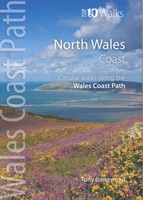 Wandelgids North Wales Coast walks | Northern Eye Books
Zeer handzaam boekje van een tiental rondwandelingen, met goede kaarten en beschrijving. Leuke toevoeging op de route of als je alleen maar naar die streek gaat en op zoek bent …
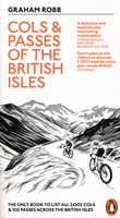 Fietsgids Cols and Passes of the British Isles
A col is the lowest point on the saddle between two mountains. Graham Robb has spent years uncovering and cataloguing the 2,002 cols and 105 passes scattered across the British …
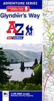 Wandelatlas Adventure Atlas Glyndwr's Way | A-Z Map Company
AZ heeft de meest gedetailleerde wandelkaarten van de Glyndwr's Way gebundeld in een atlasje. Daardoor is het heel handig qua formaat. De kaarten zelf zijn perfect voor het wandelen. Schaal …
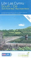 Fietskaart Cycle Route Map Lôn Las Cymru South | Sustrans
Het is niet een heel overzichtelijke kaart, het zijn juist blokken van een deel van de route waarop deze staat ingetekend. Daarin juist wel heel goed met handige stedenkaarten en …
Laatste reviews

Kan de huidige ontstuimige ontwikkelingen wereldwijd, nu ook geografisch plaatsen en daarmee beter volgen.
★★★★★ door Leo Janssen 20 december 2024 | Heeft dit artikel gekocht
We hadden Piëmonte al eens bezocht en voor onze komende reis werd ons door kennissen deze gids aanbevolen. Inderdaad is dit een heel goede gids. …
★★★★★ door DWKdB 19 december 2024 | Heeft dit artikel gekocht
Mijn bestellingen zijn altijd goed en worden altijd op tijd geleverd. Komen afspraken goed na. Erg tevreden.
★★★★★ door Ben Wegdam 19 december 2024 | Heeft dit artikel gekocht
Zeer gedetailleerde kaart van het zuidelijke deel van het douaniers pad
★★★★★ door Marian 18 december 2024 | Heeft dit artikel gekocht