Wales
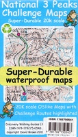 Wandelkaart National 3 Peaks Challenge Map | Discovery Walking Guides
Goede scheur- en watervaste wandelkaart. National 3 Peaks Challenge Maps. Ben Nevis, Scafell Pike and Snowdon at 20k scale. Waterproof, tearproof and 100% recyclable 820mm by 420mm double sided map …
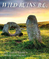 Reisgids Wild Ruins B.C.: The Explorer's Guide to Britain’s Ancient Sites | Wild Things Publishing
Discover Britain's extraordinary prehistory in this handbook to its wildest and most beautiful ancient remains. The sequel to the best-selling Wild Ruins, 18,000 copies sold. Wild ruins B.C. reveals the …
★★★★★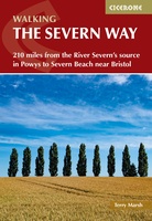 Wandelgids The Severn Way | Cicerone
Uitstekende wandelgids van de Severn Way, waarbij naast alle noodzakelijke informatie ook gebruik gemaakt wordt van de echte topografische kaart. Guidebook to walking the Severn Way, a 210 mile …
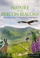 Natuurgids Nature of the Brecon Beacons | Pesda Press
Een gids met de meest voorkomende flora en fauna van de Brecon Beacons. Inclusief beschrijvingen en foto's. For most people wandering through the beautiful landscape of the Brecon Beacons …
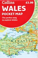 Wegenkaart - landkaart Pocket Map Wales | Collins
Kleine handzame kaart van Wales Handy little full colour map of Wales. Excellent value and very detailed for its size. Key features of this map include: • Clear mapping …
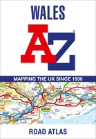 Wegenatlas Wales road atlas | A-Z Map Company
Handige wegenatlas op A5 formaat, makkelijk te gebruiken met grote letters en heel goed leesbaar. De schaal is behoorlijk gedetaileerd en zeker ook voor fietsers goed te gebruiken. Met veel …
 Wegenkaart - landkaart Südengland & Wales – Zuid-Engeland & Wales | Reise Know-How Verlag
Tweetalige kaart (Engels en Duits). Door ingetekende lengte- en breedtegraden is het gebruik van GPS mogelijk. Met hoogtelijnen en uitgebreid wegennetwerk: daarnaast worden ook de afstanden tussen belangrijke plaatsen duidelijk …
★★★★★ Reisgids I love the seaside Great Britain - Ireland, Groot Brittannie en Ierland | Mo'Media | Momedia
The I Love the Seaside Surf & Travel Guide to Great Britain & Ireland is a 464-page printed book (English language) exploring the (surf) coast of Britain and Ireland. From …
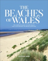 Reisgids The Beaches of Wales | Vertebrate Publishing
Surrounded on three sides by water, Wales has hundreds of beaches to choose from. The Beaches of Wales by Alistair Hare is the first guide to every beach and cove …
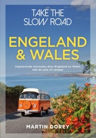 Campergids Take the Slow Road Engeland en Wales | Spectrum
Snel rijden? Echt niet! Met je voet op het gaspedaal door het landschap racen is niet meer van deze tijd. Vergeet het gehaaste leven, rustig rondtrekken is de nieuwe manier …
★★★★★ Campergids Off the Beaten Track: England and Wales | Bloomsbury
England and Wales might feel familiar to many, but there are countless hidden idylls and remote wildernesses to discover amongst the soaring passes, spectacular coastlines and boundless moorlands. For many, …
 Wegenkaart - landkaart Planning Map Wales | Lonely Planet
Durable and waterproof, with a handy slipcase and an easy-fold format, Lonely Planet's Wales Planning Map helps you get around with ease. Get more from your map and your …
★★★★★ Reisgids British Breaks Pembrokeshire | Rough Guides
Discover the best of Pembrokeshire with this compact, practical, entertaining Pocket Rough Guide. This slim, trim treasure trove of trustworthy travel information is ideal for travellers on short trips, and …
 Reisgids Heritage Weekends | Bradt Travel Guides
History and heritage are among Britain’s greatest passions. Travel writers and historians Helen and Neil Matthews have selected 52 places that are wonderful examples of natural, architectural, industrial or cultural …
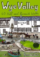 Wandelgids Wye Valley | Pocket Mountains
This guide contains forty circular routes, covering an area somewhat broader than the AONB but within similar north-south boundaries. This collection of walks is split into five areas: Hereford Lowlands …
 Wandelgids Wildlife Walks | Bloomsbury
The definitive guide to Britain's stunning wildlife heritage, showcasing more than 475 walks through the Wildlife Trust's forest, heaths, moors and woods. Published in conjunction with the Wildlife Trusts, …
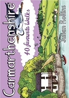 Wandelgids Carmarthenshire | Pocket Mountains
Handige compacte wandelgids met 40 dagwandelingen. Deze gids bevat kleine kaartjes en leuke uitgebreide informatie over wat er langs de route te zien is. Goede wandelkaarten zijn echter we noodzakelijk …
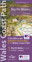 Wandelkaart North Wales Coast Path Map | Northern Eye Books
Enhanced, large scale (1: 25,000) Ordnance Survey mapping in a handy atlas format with all the mapping you need to walk a complete North Wales Coast section of the Wales …
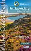 Wandelgids Wales Coast Path: Pembrokeshire | Northern Eye Books
Official Guide: Wales Coast Path: Pembrokeshire One of seven Official Guides to the Wales Coast Path The 186 mile/300km long Pembrokeshire section of the Wales Coast Path runs …
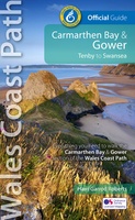 Wandelgids Wales Coast Path Carmarthen Bay & Gower | Northern Eye Books
Official Guide: Wales Coast Path: Carmarthen Bay & Gower One of seven Official Guides to the Wales Coast Path The Carmarthen Bay and Gower section of the Wales …
Laatste reviews

Kan de huidige ontstuimige ontwikkelingen wereldwijd, nu ook geografisch plaatsen en daarmee beter volgen.
★★★★★ door Leo Janssen 20 december 2024 | Heeft dit artikel gekocht
We hadden Piëmonte al eens bezocht en voor onze komende reis werd ons door kennissen deze gids aanbevolen. Inderdaad is dit een heel goede gids. …
★★★★★ door DWKdB 19 december 2024 | Heeft dit artikel gekocht
Mijn bestellingen zijn altijd goed en worden altijd op tijd geleverd. Komen afspraken goed na. Erg tevreden.
★★★★★ door Ben Wegdam 19 december 2024 | Heeft dit artikel gekocht
Zeer gedetailleerde kaart van het zuidelijke deel van het douaniers pad
★★★★★ door Marian 18 december 2024 | Heeft dit artikel gekocht