Ierland
 Accommodatiegids Charming Small Hotel guide Britain and Ireland | Duncan
Engelstalige hotelgids voor Engeland, Schotland en Ierland: informatie over chique hotels, bed & breakfast, plattelands logeerhuizen en andere plekken om te overnachten. In totaal staan er zo'n 500 hotels in …
 Wandelgids Donegal, Sligo & Leitrim | The Collins Press
The northwest of Ireland provides a diversity of walks, from the wild, untamed landscape of Donegal to the gentler hills and green valleys of Sligo and Leitrim. This guidebook describes …
 Wandelgids The Kerry Way | Rucksack Readers
Beschrijving van de Kerry Way, een bekend lange afstands pad in Ierland. Goede beschrijvingen / Engels. "An eye-catching, colourful publication with clear directions" - Irish Mountain Log The Kerry …
 Wandelgids The Dingle Way | Rucksack Readers
The Dingle Way runs for 114 miles (183 km) around Ireland’s beautiful Dingle Peninsula. It starts and finishes in Tralee, accessible by train or bus from Dublin and from Kerry …
★★★★★ Reisverhaal The Rule of the Land | Faber & Faber
In the wake of the EU referendum, the United Kingdom’s border with Ireland has gained greater significance: it is set to become the frontier with the European Union. To …
 Wandelkaart 28 Discoverer Monaghan - Keady | Ordnance Survey Northern Ireland
Zeer gedetailleerde topografische kaart met een aantal toegevoegde toeristische symbolen voor bijv. bezienswaardigheden en campings. Met hoogtelijnen, mooi kleurgebruik Op deze kaart aanwezige plaatsen: Monoghan, Middletown, Keady, Newtownhamilton, Cullyhanna, …
 Wegenkaart - landkaart Ierland, Dublin & Belfast | ITMB
Duidelijke wegenkaart van Ierland. Met stadsplattegronden van Dublin en Belfast. Aanduidingen van benzinestations, nationale parken en bezienswaardigheden.
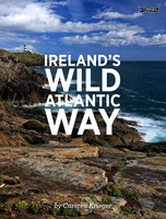
 Reisgids Ireland's Wild Atlantic Way - Ierland | The Collins Press
Deze boeiende en praktische gids is een essentiële metgezel voor elke ontdekkingsreiziger die dieper wil graven en dit spectaculaire landschap wil ontdekken. Boasting ancient tombs, atmospheric castles and sacred …
 Fotoboek Ireland's Wild Atlantic Way | O'Brien Press
Take a photographic journey down Ireland's Atlantic coast from Donegal in the north to Cork in the south. This beautiful book showcases the west coast in all its wild beauty: …
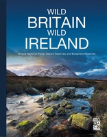 Fotoboek Wild Britain - Wild Ireland | Monaco Books
* Atmospheric mountain photography and panoramic fold-out pages* Special features on flora and fauna* Information and web addresses on protected areas and regions Britain and Ireland have so much to …
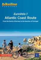 Fietsgids Bikeline Eurovelo 1 - Atlantic Coast Route | Esterbauer
Fantastische route van 11.150 km! For decades, thousands of vacationers have enjoyed cycling tours as the optimal travel method, and their numbers are growing daily. There are countless long-distance routes and …
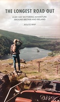
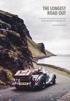 Reisverhaal The Longest Road Out | Daniel Craanen
The Longest Road Out is the road trip of a lifetime. Driving it gave us, without doubt, some of our favourite memories: from sampling succulent oysters on a sun-drenched Guernsey …
 Wegenkaart - landkaart Routemap The Longest Road Out | Longestroadout
Deze kaart hoort bij het boek The Longest Road Out
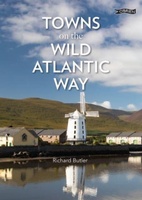 Reisgids Towns on the Wild Atlantic Way | O'Brien Press
From the drama of Donegal to the beauty of west Cork, the 2,500km Wild Atlantic Way is one of the world's greatest tourist routes. The unique towns along the way …
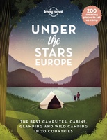 Reisinspiratieboek Under the Stars - Europe | Lonely Planet
From wild camping to curling up in a cabin, discover 200 amazing places to sleep under the stars in Europe. Lonely Planet's experts have scoured the continent to recommend the …
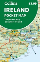 Wegenkaart - landkaart Pocket Map Ireland pocket map - Ierland | Collins
Kleine handzame kaart van Ierland. Explore Ireland with this handy, full colour map. Handy little full colour map of Ireland at an excellent price. It is double-sided, with the …
★★★★★ Spoorwegenkaart Europe Western Railroad & Road | ITMB
Spoorwegen kaart van West Europa in kleur. Schaal 1:2,500,000. Toont spoorlijnen, snelwegen, secundaire wegen en andere wegen, veerboten en belangrijke scheepvaartdiensten; internationale grenzen, de grenzen van de gebieden met reisbeperkingen; …
★★★★★ Wandelgids The Kerry Way | The Collins Press
Handzame kleine gids van de Kerry Way. Vereenvoudigd kaartmateriaal maakt het makkelijk om te gebruiken, goede tekst. The Kerry Way is Ireland's longest marked trail and one of the most …
 Reisgids Wild Atlantic Way - Where to eat and stay | Collins
Een handzame gids met de beste plekken om te eten en overnachten langs de Wild Atlantic Way in Ierland. A guide to the best places to enjoy the local Irish …
★★★★★ Wandelgids 5988 Wanderführer Irland und Nordirland - Ierland en Noord Ierland | Kompass
Goede Duitstalige wandelgids met heldere beschrijvingen van de wandeltochten. Met hoogteprofiel, kaartje en de benodigde praktische informatie als bijvoorbeeld de startlocatie met GPS coordinaten. De wandelingen zijn ingedeeld in zwaarte …
Laatste reviews

Kan de huidige ontstuimige ontwikkelingen wereldwijd, nu ook geografisch plaatsen en daarmee beter volgen.
★★★★★ door Leo Janssen 20 december 2024 | Heeft dit artikel gekocht
We hadden Piëmonte al eens bezocht en voor onze komende reis werd ons door kennissen deze gids aanbevolen. Inderdaad is dit een heel goede gids. …
★★★★★ door DWKdB 19 december 2024 | Heeft dit artikel gekocht
Mijn bestellingen zijn altijd goed en worden altijd op tijd geleverd. Komen afspraken goed na. Erg tevreden.
★★★★★ door Ben Wegdam 19 december 2024 | Heeft dit artikel gekocht
Zeer gedetailleerde kaart van het zuidelijke deel van het douaniers pad
★★★★★ door Marian 18 december 2024 | Heeft dit artikel gekocht