Ierland
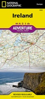 Wegenkaart - landkaart 3303 Adventure Map Ireland - Ierland | National Geographic
Wegenkaart van Ierland met vermelding van veel bezienswaardigheden, nationale parken en attrakties. Watervast en scheurvast. Juist door deze vermeldingen onderscheidt de kaart zich van andere wegenkaarten. National Geographic's Ireland Adventure …
★★★★★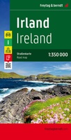 Wegenkaart - landkaart Ierland | Freytag & Berndt
Goede tweezijdige wegenkaart van het hele land. Met register en enkele stadsplattegronden. De berijdbare wegen zijn goed weergeven, zowel de hoofdwegen als provinciale en lokale wegen; wegnummers worden vermeld. …
★★★★★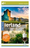 Reisgids ANWB Ontdek Ierland | ANWB Media
Een nieuwe ANWB reisgids: deze titel is een vertaling van de Duitstalige Dumont reeks. Ze staan bekend als zeer degelijke en behoorlijk complete reisgisden in compact formaat. Met zowel veel …
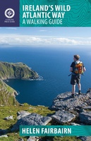 Wandelgids Ireland's Wild Atlantic Way | The Collins Press
Duidelijke wandelgids van dit specifieke deel van Ierland. Goede praktische informatie en zeker voor de GPS wandelaar handig met vermelde waypoints. Kaarten zijn schetsmatig, maar er wordt verwezen naar de …
★★★★★ Campinggids Campingführer Deutschland & Nordeuropa - Duitsland & Noord Europa 2024 | ADAC
Erg uitgebreide campinggids van Noord Europa, in het Duits. Met gratis ADAC kortingskaart. Mit dem ADAC Campingführer Deutschland/Nordeuropa wird die Suche nach dem perfekten Campingplatz zum Vergnügen. Ob Urlaub vor …
★★★★★ Wegenatlas Big Atlas Britain & Ireland 2024 A3-Formaat | Philip's Maps
Goede gedetailleerde wegenatlas van Groot-Brittannië, schaal 1:200.000 met een overzichtskaart van Ierland, schaal 1:1.000.000. Groot formaat, A3, en in ringband. 'Good balance between detail and clarity with excellent town maps' …
★★★★★ Reisgids I love the seaside Great Britain - Ireland, Groot Brittannie en Ierland | Mo'Media | Momedia
The I Love the Seaside Surf & Travel Guide to Great Britain & Ireland is a 464-page printed book (English language) exploring the (surf) coast of Britain and Ireland. From …
 Reisverhaal What's the story? | José Bryan
“WHAT’S THE STORY?” Op reis langs de verhalen van Ierland Weergaloos nieuw boek dat je, met een lach en een traan, meeneemt op reis naar het mystieke Ierland. De schrijfster …
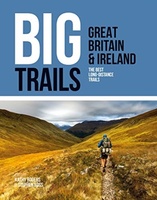 Wandelgids Great Britain & Ireland | Vertebrate Publishing
Big Trails: Great Britain & Ireland is an inspirational guide to the most iconic, spectacular and popular long-distance trails in England, Scotland, Wales, Northern Ireland, Ireland and the Isle of …
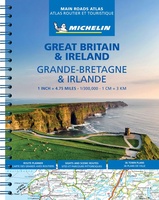 Wegenatlas Great Britain and Ireland 2024 - Main Roads Atlas (A4-Spiral) | Michelin
Full of practical features, the Michelin Great Britain & Ireland 2024 - Main Roads Atlas (A4-Spiral) is the perfect companion for your everyday journey and holiday planning. Updated every year, …
★★★★★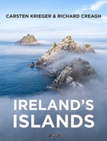 Fotoboek Ireland's Islands | O'Brien Press
Hardcover fotoboek met mooie foto's en begeleidende teksten van de beeldschone Ierse eilanden. Take a photographic journey around Ireland's coast and explore the landscape, history, heritage and wildlife of the …
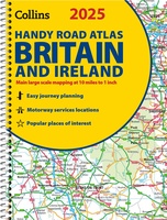 Wegenatlas 2025 Collins Handy Road Atlas Britain and Ireland | Collins
Handzame A5 wegenatlas van Engeland, Wales, Schotland en Ierland met register en stadsplattegronden This easy-to-use, handy A5 sized road atlas with popular lie-flat spiral binding features extremely clear route planning …
★★★★★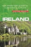 Reisgids Culture Smart! Ireland- Ierland | Kuperard
De Cultuur Bewust!-gids geeft toeristen en zakenlieden belangrijke informatie met betrekking tot de cultuur van alledag in het land van bestemming. Anders dan in de gebruikelijke reisgidsen wordt de lezer …
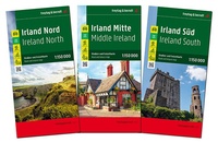 Wegenkaart - landkaart Ierland | Freytag & Berndt
Heel Ierland op zeer gedetailleerde schaal, bestaat uit een set van 3 kaarten in een plastic hoes. Een uitstekende kaart van Ierland met toeristische informatie, jachthavens, stranden, vele wandelpaden …
★★★★★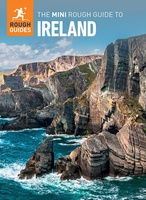 Reisgids Mini Rough Guide Ireland | Rough Guides
Een kleinere versie in zakformaat van de grotere versies van de Rough Guides. Als altijd weer vol met goede informatie over cultuur en praktische zaken. Achterin kleine plattegronden. Compact, concise …
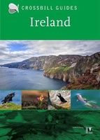 Natuurgids Crossbill Guides Ireland | KNNV Uitgeverij
Ireland, the Emerald Isle, is famous for its checkerboard landscape of green fields and hedgerows. Its coast showcases sandy beaches, mudflats and saltmarshes, Atlantic Rainforests, rocky shores and cliffs, all …
★★★★★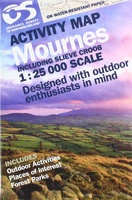 Wandelkaart The Mournes | Ordnance Survey Ireland
From the rugged granite peaks of the mountains to the picturesque coastline below, the Mournes region is an Area of Outstanding Natural Beauty. This guide map has information about climbing, …
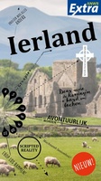 Reisgids ANWB extra Ierland | ANWB Media
Beleef Ierland met de compleet vernieuwde reisgids ANWB Extra Ierland! Ierland is groen, traditioneel, ouderwets, gezellig kleurrijk, innovatief, modern, opwindend en multicultureel. Dat alles maakt Ierland een perfecte bestemming voor …
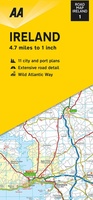 Wegenkaart - landkaart Ireland - Ierland | AA Publishing
Folded, double-sided sheet map shows the detailed road network with toll motorways and dual carriageways identified. Includes motorway service areas, AA-inspected campsites, viewpoints and picnic sites. Gaeltacht regions are highlighted …
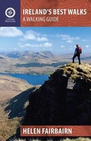 Wandelgids Ireland's Best Walks | The Collins Press
Duidelijke wandelgids van Ierland: Goede praktische informatie en zeker voor de GPS wandelaar handig met vermelde waypoints. Kaarten zijn schetsmatig, maar er wordt verwezen naar de benodigde topografische kaarten van …
Laatste reviews

Kan de huidige ontstuimige ontwikkelingen wereldwijd, nu ook geografisch plaatsen en daarmee beter volgen.
★★★★★ door Leo Janssen 20 december 2024 | Heeft dit artikel gekocht
We hadden Piëmonte al eens bezocht en voor onze komende reis werd ons door kennissen deze gids aanbevolen. Inderdaad is dit een heel goede gids. …
★★★★★ door DWKdB 19 december 2024 | Heeft dit artikel gekocht
Mijn bestellingen zijn altijd goed en worden altijd op tijd geleverd. Komen afspraken goed na. Erg tevreden.
★★★★★ door Ben Wegdam 19 december 2024 | Heeft dit artikel gekocht
Zeer gedetailleerde kaart van het zuidelijke deel van het douaniers pad
★★★★★ door Marian 18 december 2024 | Heeft dit artikel gekocht