Engeland
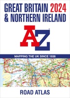 Wegenatlas Great Britain and Northern Ireland Road Atlas 2024 | A-Z Map Company
A full-colour, paperback road atlas of Great Britain, now fully revised and updated. Clear detailed road mapping at a scale of 3.5 miles to 1 inch. Presented in a large, …
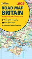 Wegenkaart - landkaart Road Map of Britain 2025 | Collins
Full-colour, double-sided road map of Great Britain at a scale of 8.7 miles to 1 inch. Northern England, Scotland and the Isle of Man are on one side with Southern …
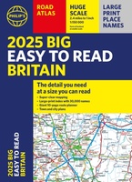 Wegenatlas Philip's Easy to Read Road Atlas of Britain 2025 | A3-Formaat | Paperback | Philip's Maps
With the detail you need at a size you can read, the latest edition of 2025 Philip's Big Easy to Read Road Atlas of Britain is super-clear, super-sized and bang …
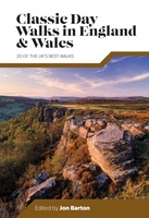 Wandelgids Day Walks Classic Day Walks in England & Wales | Vertebrate Publishing
Classic Day Walks in England & Wales features a selection of 20 of the best day-length hillwalking routes from Vertebrate Publishing's popular series of walking guidebooks. Edited by Jon Barton, …
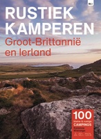 Campinggids Rustiek Kamperen in Groot-Brittannië en Ierland | Bert Loorbach Uitgeverij
De serie Rustiek Kamperen heeft in de afgelopen twintig jaar een grote schare liefhebbers van natuurlijk en kleinschalig kamperen opgebouwd. Met deze geheel nieuwe gids heb je de beste selectie …
★★★★★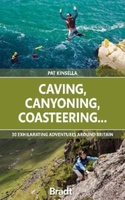 Reisgids Caving, Canyoning, Coasteering | Bradt Travel Guides
You don't need to be ultra-fit or highly experienced in the outdoors to enjoy outdoor guru Patrick Kinsella's selection of 30 activities across Britain. 'A sense of adventure and an …
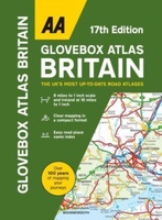 Wegenatlas AA Glovebox Atlas Britain | AA Publishing
This handy atlas fits in the glovebox of your car, perfect for quick referencing on the move. The clear mapping includes a range of essential motoring and useful touring information …
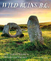 Reisgids Wild Ruins B.C.: The Explorer's Guide to Britain’s Ancient Sites | Wild Things Publishing
Discover Britain's extraordinary prehistory in this handbook to its wildest and most beautiful ancient remains. The sequel to the best-selling Wild Ruins, 18,000 copies sold. Wild ruins B.C. reveals the …
★★★★★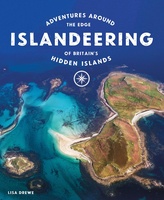 Reisgids Islandeering: Adventures Around Britain's Hidden Islands | Wild Things Publishing
Walk, scramble, cycle, wade or even swim around the outer edge of our wildest islands. Islandeering provides all the information you need to circumnavigate 50 amazing hidden islands off the …
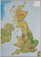 Reliëfkaart Great Britain & Ireland - Groot Brittannië & Ierland | GeoRelief
De uitgever van de kaart is de bekende Duitse uitgever GeoRelief. Deze topografische kaart van Groot Brittannië heeft een hoge kwaliteit met prachtige kleuren. De kaart bevat de namen van …
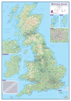 Wandkaart Engeland - British Isles roadplanning wall map, 84 X 119 cm | Maps International
Routeplanner map from Maps International's selection of British Isles maps. Routeplanning map details: British Isles routeplanning map shows the motorways, major roads and transport hubs such as airports and …
 Accommodatiegids Cool Places | Punk Publishing
A lavish full-colour guide to the very best places to stay in the UK: everything from boutique hotels and designer B&Bs to chic country cottages and luxury glampsites. Inspired by …
 Fietsgids Best Bike Rides Great Britain | Lonely Planet
Lonely Planet's Best Bike Rides Great Britain is your passport to 40 day trips on two wheels. Use pedal power to see a destination through a new lens by picking …
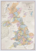 Wandkaart Classic Verenigd Koninkrijk | UK | Great Brittain | 85 x 60 cm | Maps International
Ontdek de rijke historie en schilderachtige landschappen van het Verenigd Koninkrijk met onze prachtige wandkaart, vormgegeven in een elegante klassieke stijl. Deze gedetailleerde kaart toont niet alleen de verschillende landen …
 Reisverhaal Wat bezielt de Engelsen? | Jochem Wijnands
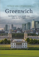 Reisverhaal Groeten uit Greenwich | Patrick van IJzendoorn
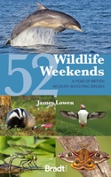 Reisgids 52 Wildlife Weekends in Britain | Bradt Travel Guides
Bradt's popular guidebook 52 Wildlife Weekends suggests inspiring itineraries for 52 unforgettable wildlife-watching breaks covering the whole of Britain, from southwest England to northern Scotland - each perfectly timed for …
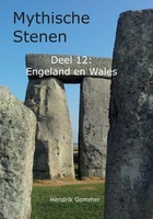 Reisgids Mythische Stenen Deel 12: Engeland en Wales | MythicalStones.eu
 Spoorwegenkaart The British Isles by Train and Ferry | Cosmographics
Plan your journey and explore the British Isles by train and ferry. This attractive, detailed map shows how the rail network, along with ferries to the more isolated areas, allows …
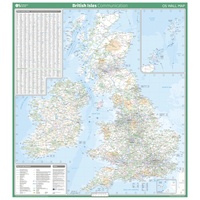 Wandkaart British Isles Communication | 93 x 104 cm | Ordnance Survey
Laatste reviews

De kaart is uitgevouwen zo'n 60 cm x 80 cm (2-zijdig). En daarop staat met een schaal van 1: 1.500.000 een kwart van India! Deze …
★★★★★ door Arjan 08 januari 2025 | Heeft dit artikel gekocht
Snelle en correctelevering van de kaart van Noorwegen. Een prachtige en overzichtelijke kaart die een goede indruk geeft van het landschap met hoogtelijnen.
★★★★★ door Hanneke van Dam 07 januari 2025 | Heeft dit artikel gekocht
Blij dat De Zwerver deze perfecte, franstalige IGN gidsen aanbiedt en dan óók met een woordenlijst erbij gevoegd. De voorbereiding kan beginnen na een vlotte …
★★★★★ door Lie van Schelven 06 januari 2025 | Heeft dit artikel gekocht
Voor een paar dagen Leipzig een prima reisgids. Het deel voor Dresden is aanmerkelijk groter maar was niet hinderlijk.
★★★★★ door J.A. Pazie 06 januari 2025 | Heeft dit artikel gekocht

