Engeland
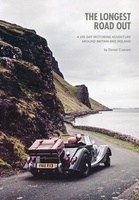 Reisverhaal The Longest Road Out | Daniel Craanen
The Longest Road Out is the road trip of a lifetime. Driving it gave us, without doubt, some of our favourite memories: from sampling succulent oysters on a sun-drenched Guernsey …
 Wegenkaart - landkaart Routemap The Longest Road Out | Longestroadout
Deze kaart hoort bij het boek The Longest Road Out
 Reisinspiratieboek Under the Stars - Europe | Lonely Planet
From wild camping to curling up in a cabin, discover 200 amazing places to sleep under the stars in Europe. Lonely Planet's experts have scoured the continent to recommend the …
 Wegenatlas Easy to Read Road Atlas Britain 2025 | Philip's Maps
"The detail you need at a size you can read". The latest 2025 Philip's Easy to Read Road Atlas of Britain from the best-selling Road Atlas range has over 350 …
★★★★★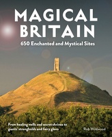 Reisgids Magical Britain Rediscovering Our Animist Landscapes & Sacred Sites | Wild Things Publishing
This richly illustrated guide to 650 places will appeal to those who want to explore Britain's lost animist landscape of fairies, folklore, myth and paganism. Discover pre-Christian healing shrines and …
 Fietskaart 5 Tour Map Devon & Somerset West | Ordnance Survey
De Ordnance Survey Tour Maps met schaal 1:130.000 zijn uitstekend geschikt om zelf je fietsvakantie te plannen in Engeland. Ze laten alle alle grote en kleinere wegen zien. Bovendien staan …
★★★★★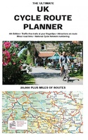 Fietskaart The Ultimate UK Cycle Route Planner | Excellent Books
Fully updated and revised 4th edition for 2022 with an increased sheet size. One of the best selling UK cycle publications giving an overview of all the main signed UK …
★★★★★ Campinggids Tiny Campsites in Engeland, Schotland en Wales | AA Publishing
Eindelijk een gids voor de echte kampeerder in Engeland, Schotland en Wales: prettig kleine kampeerplekken in de middle of nowhere. We’ve all been there. You venture out into the countryside …
 Wandelkaart Offa's Dyke Path | Harvey Maps
Wandelkaart van het Offa's Dyke Path met uitsnedes van de route. Entire route on one map Offa's Dyke Path is a National Trail 285km long (178 miles) along the …
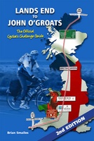 Fietsgids Lands End to John O'Groats (2nd Edition) The Official Cycllist's Challenge Guide | Challenge Publications
There are numerous outdoor challenges in life around the UK. Canoeing the Caledonian Canal from one side of the country to the other, walking around Britain on the coastal footpath …
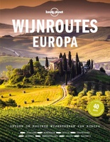 Reisgids Lonely Planet NL Wijnroutes Europa | Kosmos Uitgevers
De wijnroutes van Lonely Planet voeren je van Alentejo in Portugal naar Transsylvanië in Roemenië. Ontmoet wijnmakers van de beste wijnhuizen in de verschillende regio’s en maak kennis met hun …
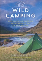 Campinggids Wild Camping UK and Ireland | Conway
Als je echt op zoek bent naar bijzondere kampeerplekken in Engeland, Schotland en Ierland dan is dit je boek: het beschijft de meest afgelegen plekkenin het wild waar je je …
 Reisgids Lannoo's Autoboek Engeland en Wales | Lannoo
Drie uitgestippelde autoroutes en twee stadswandelingen loodsen je oor de fraaiste regio's Atlas met kaarten op schaal 1:750.000 en meer dan 700 kleurenfoto's Handige geografische indeling en sterrenquotering England en …
 Campinggids - Campergids Cool Camping Coast | Punk Publishing
In recognition of the nation's love for the Great British coastline, 2018 sees the launch of a brand new guidebook - Cool Camping: Coast - the latest title in the …
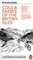 Fietsgids Cols and Passes of the British Isles
A col is the lowest point on the saddle between two mountains. Graham Robb has spent years uncovering and cataloguing the 2,002 cols and 105 passes scattered across the British …
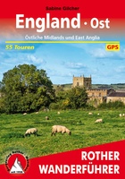 Wandelgids England Ost - Engeland oost | Rother Bergverlag
Duitstalige wandelgids van de Midlans en oost Anglia met zeer goed beschreven wandelingen in de wandelgebieden. Redelijk kaartmateriaal, vooral de beschrijving van de route en de praktische info die er …
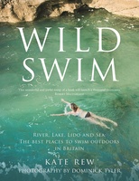 Reisgids Wild Swim Britain | Guardian Faber Publishing
In this stunning and inspiring guide, Kate Rew, founder of the Outdoor Swimming Society, takes you on a wild journey across Britain, braving the elements to experience first-hand some of …
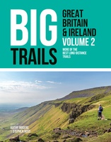 Wandelgids Big Trails Great Britain & Ireland Volume 2 | Vertebrate Publishing
Big Trails: Great Britain and Ireland Volume 2 is the second volume of this inspirational guide to the most iconic long-distance trails in England, Scotland, Wales, Ireland and the Channel …
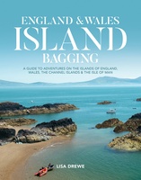 Reisgids England and Wales Island Bagging | Vertebrate Publishing
England & Wales Island Bagging by Lisa Drewe is a stunning and informative guide to the islands of England, Wales, the Channel Islands and the Isle of Man. It is …
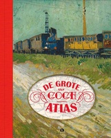 Reisgids - Reisverhaal De grote Van Gogh atlas | Nienke Denekamp, René van Blerk
Vincent van Gogh leefde in een spannende tijd. De moderne wereld was volop in beweging door de opkomst van een wijdvertakt spoorwegnet in Europa. En Vincent bewoog mee! In De …
★★★★★
Laatste reviews

De kaart is uitgevouwen zo'n 60 cm x 80 cm (2-zijdig). En daarop staat met een schaal van 1: 1.500.000 een kwart van India! Deze …
★★★★★ door Arjan 08 januari 2025 | Heeft dit artikel gekocht
Snelle en correctelevering van de kaart van Noorwegen. Een prachtige en overzichtelijke kaart die een goede indruk geeft van het landschap met hoogtelijnen.
★★★★★ door Hanneke van Dam 07 januari 2025 | Heeft dit artikel gekocht
Blij dat De Zwerver deze perfecte, franstalige IGN gidsen aanbiedt en dan óók met een woordenlijst erbij gevoegd. De voorbereiding kan beginnen na een vlotte …
★★★★★ door Lie van Schelven 06 januari 2025 | Heeft dit artikel gekocht
Voor een paar dagen Leipzig een prima reisgids. Het deel voor Dresden is aanmerkelijk groter maar was niet hinderlijk.
★★★★★ door J.A. Pazie 06 januari 2025 | Heeft dit artikel gekocht

