Superwalker XT25 maps
De ultieme kaarten voor wandelaars: ontdek de Super Walker XT25 Maps van Harvey Maps
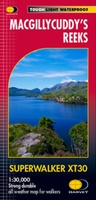 Wandelkaart Macgillycuddy's Reeks | Harvey Maps
Een bijzonder handige kaart van dit gebied. Op waterafstotend papier met veel details. Includes the whole of the Killarney National Park. Detailed map for hillwalkers of MacGillycuddy’s Reeks at …
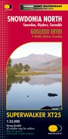 Wandelkaart Snowdonia Noord /Snowdon,Glyders,Carnedds | Harvey Maps
New Revised Edition and Format. More than a map, an essential piece of equipment this new generation HARVEY Superwalker is designed to be the most practical tool for navigation outdoors. …
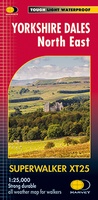 Wandelkaart Yorkshire Dales Noord-Oost | Harvey Maps
The Yorkshire Dales National Park on just 4 sheets. Yorkshire Dales North East: The coverage of this map includes Swaledale, Wharfedale, Wensleydale and Nidderdale. Genuine original HARVEY mapping at 1:25,000. …
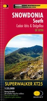 Wandelkaart Snowdonia South | Harvey Maps
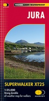 Wandelkaart Jura - Schotland | Harvey Maps
Shows the Paps of Jura and includes 1 Corbett and 2 Grahams. This detailed map for hillwalkers shows the whole of the Isle of Jura at the popular 1:25,000 …
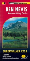 Wandelkaart Ben Nevis | Harvey Maps
Een bijzonder mooie en handige kaart van dit prachtige bergachtige gebied. Op waterafstotend papier met veel details. HARVEY Superwalker map at 1:25,000 scale Detailed map of Ben Nevis for walkers …
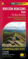 Wandelkaart Brecon Beacons Oost | Harvey Maps
Includes Pen y Fan and the Black Mountains. Detailed map for hillwalkers of the western part of the Brecon Beacons National Park at the popular scale of 1:25,000. …
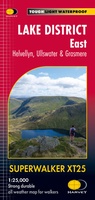 Wandelkaart Lake District East | Harvey Maps
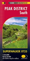 Wandelkaart Peak District South | Harvey Maps
Een bijzonder handige kaart van dit gebied. Op waterafstotend papier met veel details. Covers the area from Buxton to Matlock. Includes Leek, the Roaches and Dovedale. Detailed map for …
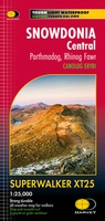 Wandelkaart Snowdonia Central | Harvey Maps
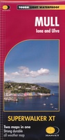 Wandelkaart Mull - Iona - Ulva | Harvey Maps
Zeer duidelijke kaart van Mull, met o.a. hoogtelijnen en geschikt voor gebruik met GPS.Two maps in one! 1:25,000 scale walking map of the mountains of Mull with a recreation …
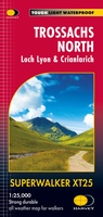 Wandelkaart Trossachs Noord / Loch Lyon / Crianlarich | Harvey Maps
More than a map - an essential piece of equipment. This new generation HARVEY Superwalker is designed to be the most practical tool for navigation outdoors. - Includes the iconic …
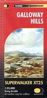 Wandelkaart Galloway Hills | Harvey Maps
The Galloway Hills form part of the Southern Uplands of Scotland. This map for hillwalkers covers Glen Trool and Loch Dee north to Loch Doon and Carrick Forest. It covers …
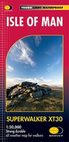 Wandelkaart Isle of Man | Harvey Maps
Een bijzonder handige kaart van dit gebied. Op waterafstotend papier met veel details. Includes long distance routes, rights of way and Public Ramblage. Detailed map for hillwalkers at 1:30,000 …
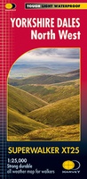 Wandelkaart Yorkshire Dales Noord-West | Harvey Maps
The Yorkshire Dales National Park on just 4 sheets. Yorkshire Dales North West: The coverage of this map includes The Howgill Fells, upper Wensleydale and upper Swaledale. Genuine original HARVEY …
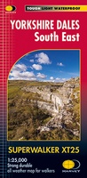 Wandelkaart Yorkshire Dales Zuid-Oost | Harvey Maps
The Yorkshire Dales National Park on just 4 sheets. Yorkshire Dales South East: The coverage of this map includes Pen-y-Ghent, Malham Cove, Wharfedale and Nidderdale. Genuine original HARVEY mapping at …
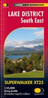 Wandelkaart Lake District Zuid Oost | Harvey Maps
Superwalker XT25 of the Lake District. Revised and re-designed. It's got everything! Genuine original HARVEY mapping at 1:25,000. Clear, easy to read. Easy to re-fold. Opens directly to either side …
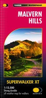 Wandelkaart Malvern Hills | Harvey Maps
Shows the whole of the ridge from North Malvern to Whiteleaved Oak, including the Herefordshire and Worcestershire Beacons. Detailed map for walkers, cyclists and horseriders of the Malvern Hills …
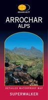 Wandelkaart Arrochar Alps | Harvey Maps
Includes Beinn Ime, Ben Vorlich and the Cobbler (Ben Arthur). Detailed map for hillwalkers of the western part of the Loch Lomond and Trossachs National Park at the popular scale …
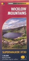 Wandelkaart Wicklow Mountains | Harvey Maps
Zeer duidelijke kaart van de Wicklow Mountains in Ierland. Met o.a. hoogtelijnen en geschikt voor gebruik met GPS. HARVEY Superwalker map at 1:30,000 scale. Clear, easy to use, waterproof. GPS …
★★★★★
Laatste reviews

Heb de gids cadeau gedaan en die persoon was er heel blij mee ..
★★★★★ door J 21 november 2024 | Heeft dit artikel gekocht
De kaart van Kirgystan is prachtig, zeer gedetailleerd. Kan niet wachten tot de we echt op reis hmgaan die kant op.
★★★★★ door Marijke Eering 21 november 2024 | Heeft dit artikel gekocht
Super handig fiets boekje en mooi water bestendig. En handig om op de kaarten te kijken heel duidelijk beschrijving. Wij fietsen al jaren in Duitsland …
★★★★★ door Jenneke holterman 19 november 2024 | Heeft dit artikel gekocht
prima kaart levering en betaling allemaal vlot verlopen
★★★★★ door Marc Buts 19 november 2024 | Heeft dit artikel gekocht