Kaarten - Noord-Amerika
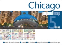
 Stadsplattegrond Popout Map Chicago | Compass Maps
Let PopOut Chicago guide you around this wonderful city. Discover the 'Windy City' of Chicago with the help of this genuinely pocket-sized, pop-up map. Small in size, yet big on …
 Wegenkaart - landkaart British Columbia & Alberta Rockies | ITMB
Een degelijke kaart met aanduidingen van o.a. nationale parken, vliegveld, benzinepomp, dirt-roads en kleine plattegrond van hoofdstad. Als overzichtskaart goed te gebruiken. The Rocky Mountain chain forms the boundary between …
 Wegenkaart - landkaart Honolulu and Oahu | ITMB
Een degelijke kaart met aanduidingen van o.a. nationale parken, vliegveld, benzinepomp, dirt-roads en kleine plattegrond van hoofdstad. As overzichtskaart goed te gebruiken. Schaal: - Oahu 1:80.000 - Honolulu 1:18.000 Honolulu/Waikiki …
 Wegenkaart - landkaart - Stadsplattegrond San Diego - California south | ITMB
Wegenkaart en stadsplattegrond in een kaart: aan de ene zijde San Diego stadsplattegrond en op de andere kant een kaart van het zuiden van Californië. San Diego on a clear, …
 Wegenkaart - landkaart Hawaii Volcanoes National Park & Big Island | ITMB
Een degelijke kaart met aanduidingen van o.a. nationale parken, vliegveld, benzinepomp, dirt-roads. Als overzichtskaart goed te gebruiken. We didn't suspect, when we started developing this title, that Mauna Loa Volcano …
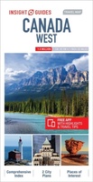
 Wegenkaart - landkaart Canada West | Insight Guides
Insight Travel Map Canada West:This detailed travel map is all you need to plan your route and navigate your way around Canada West, and also includes area highlights, top attractions, …
 Wandelkaart 742 Lake Placid, High Peaks: Adirondack Park Map | National Geographic
National Geographic's Trails Illustrated Maps are the most detailed and up-to-date topographic recreation maps available for US National Parks, National Forests and other popular outdoor recreation areas. A necessity for …
 Wegenkaart - landkaart Planning Map Canada | Lonely Planet
Durable and waterproof, with a handy slipcase and an easy-fold format, Lonely Planet's Canada Planning Map is your conveniently-sized passport to traveling with ease. With this easy-to-use, full color navigation …
 Wegenkaart - landkaart Planning Map USA | Lonely Planet
Durable and waterproof, with a handy slipcase and an easy-fold format, Lonely Planet USA Planning Map is your conveniently-sized passport to traveling with ease. Get more from your map and …
 Wegenkaart - landkaart New Orleans - Mississippi River Basin | ITMB
New Orleans stadsplattegrond met schaal 1:15.000, bijzonder uitgebreid. ITMB is pleased to continue its detailed coverage of the USA with its first-ever map of the historic City of New Orleans. …
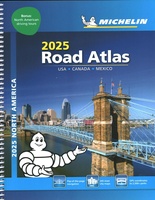
 Wegenatlas Road Atlas USA Canada Mexico 2025 | A4-Formaat | Ringband | Michelin
De beroemde wegenatlas van Rand McNally nu als Michelin atlas. Super handige atlas van Michelin in A4 formaat met stevige ringband. Let op: Canada en Mexico staan er zeer beperkt in. …
 Stadsplattegrond - Wegenkaart - landkaart Quebec City & Gaspe Peninsula | ITMB
Een degelijke kaart aan twee kanten bedrukt. Aan de ene zijde een plattegrond van Quebec stad, schaal 1:10.000. En aan de andere zijde een wegenkaart, schaal 1:750.000, van Gaspe schiereiland …
 Wandelkaart Yosemite & Central California | ITMB
The USA is blessed with many wonderful parks, forests, and natural monuments that have been preserved for all to enjoy. The second most-visited national park (after Yellowstone) is Yosemite (pronounced …
 Wegenkaart - landkaart Atlantic Canada | ITMB
The first edition was published in 2000 using artwork under licence. This edition uses original ITMB artwork. Side 1 covers Nova Scotia, New Brunswick, and Prince Edward Island as well …
 Stadsplattegrond Plan de ville - Street Map New York | Michelin
NEW. The Michelin New York Map - part of Michelin's brand-new Laminated City Map series - is ideal for visitors wanting to see the sights and navigate around the city. …
 Wegenkaart - landkaart 3128 Adventure Travel Map Vancouver Island | National Geographic
Wegenkaart van Vancouver Island met vermelding van veel bezienswaardigheden, nationale parken en attrakties. Watervast en scheurvast. Juist door deze vermeldingen onderscheidt de kaart zich van andere wegenkaarten. National Geographic's Vancouver …
 Wegenkaart - landkaart Tofino & Southern Vancouver Island | ITMB
Vancouver Island is one of the marvels of tourism in Canada. It is, in fact, so big that it needs to be explored in sections to reach its full potential. …
 Wegenkaart - landkaart Seattle & Washington State | ITMB
This is a new title for ITMB, in that it is the first time we have mapped the State of Washington. The actual area of the map includes Portland and …
 Wegenkaart - landkaart Yellowstone National Park and Wyoming | ITMB
The USA is a vast and wonderful land to explore. ITMB is steadily increasing our coverage of this important travel destination and this month concentrates on the State of Wyoming, …
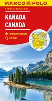
 Wegenkaart - landkaart Kanada - Canada | Marco Polo
Marco Polo Canada Map: the ideal map for your trip Let the Marco Polo Canada Map guide you around this incredible country. Plan your great Canadian road trip with …
Laatste reviews

Super handig fiets boekje en mooi water bestendig. En handig om op de kaarten te kijken heel duidelijk beschrijving. Wij fietsen al jaren in Duitsland …
★★★★★ door Jenneke holterman 19 november 2024 | Heeft dit artikel gekocht
prima kaart levering en betaling allemaal vlot verlopen
★★★★★ door Marc Buts 19 november 2024 | Heeft dit artikel gekocht
Ik heb een uitklapbare kaart van Londen gekocht voor toeristische doeleinden. Snel geleverd en een product die volledig voldoet aan de behoeften. Chapeau!
★★★★★ door Cees Lindenberg 18 november 2024 | Heeft dit artikel gekocht
Mooi stevig, klein koffertje. Ik had eerst de 'middenmaat' besteld maar die was helaas niet meer leverbaar. Snelle en goede communicatie hierover. Het kleinste formaat …
★★★★★ door Marieke 17 november 2024 | Heeft dit artikel gekocht

