South West England
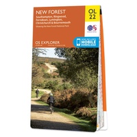 Wandelkaart - Topografische kaart OL22 OS Explorer Map New Forest | Ordnance Survey
Een van de beste detailkaarten die er op de wereld gemaakt worden: zeer gedetailleerd, prachtig helder kleurgebruik, veel topografische aspecten en - zeer belangrijk - allerlei toeristische en recreatieve aspecten …
 Reisgids Trotter Zuid Engeland | Lannoo
Veel aandacht voor praktische informatie als hotels en restaurants, maar ook beschrijvingen van bezienswaardigheden. Handig zijn de vele plattegronden: verrassend en verfrissend geschreven! Geen foto's. Een must voor elke reiziger …
 Wegenkaart - landkaart 1 Road Map Britain The West Country and South Wales | AA Publishing
Goede dubbelzijdige Wegenkaart met plaatsnamenindex van Zuid-West Engeland en het zuidelijkste stukje van Wales met op de achterkant een aantal (beknopte) stadsplattegronden. Fully updated, the maps combine clear design and …
★★★★★★★★★★ Wegenkaart - landkaart 2 Road Map Britain Central Southern England | AA Publishing
Goede dubbelzijdige Wegenkaart met plaatsnamenindex van het centrale deel van het zuiden van Engeland. Grof geschetst is het een rechthoek tussen Gloucester, Luton, London, Dorcester en Brighton. Britain’s clearest mapping …
★★★★★ Reisgids Dorset, Hampshire and the Isle of Wight | Rough Guides
Zeer goede reisgids voor zowel de georganiseerde maar vooral voor de zelfstandige reiziger. Boordevol informatie over reizen, slapen, eten, maar ook musea en cultuur. Voor veel landen meestal completer en …
★★★★★★★★★★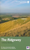 Wandelgids The Ridgeway - National Trail Guides | Aurum Press
Uitstekend routeboek met goede kaarten van Ordnance Survey. Praktische info voor overnachten enigzins beperkt achterin. The Ridgeway follows one of the oldest ‘green roads’ in Europe. It runs for 87 …
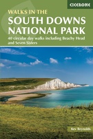 Wandelgids Walking in the South Downs National Park | Cicerone
Goede wandelgids uit de bekende Cicerone serie, dus met mooie foto's en duidelijke routebeschrijvingen en kaartjes. A guidebook to 40 circular day walks in the South Downs National Park. Exploring …
 Wandelgids Walking in the Thames Valley | Cicerone
Walking in the Thames Valley offers 25 challenging circular walks around the River Thames and River Kennet in the south of England, taking in the Southern Chilterns, the Berkshire and …
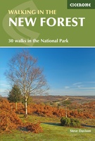 Wandelgids Walking in the New Forest | Cicerone
Goede wandelgids met veel dagtochten, geschikt voor iedereen. A guidebook to 30 walks of between 3 and 10 miles set throughout the New Forest National Park in Hampshire and …
★★★★★ Pocket Street Map Exeter | A-Z Map Company
Navigate your way around Exeter with detailed street maps from A-Z This up-to-date, folded A-Z street map includes over 2,100 streets in and around Exeter. As well as the central …
 Stadsplattegrond Pocket Street Map Torquay | A-Z Map Company
Navigate your way around Torquay with detailed street maps from A-Z This up-to-date, folded A-Z street map includes all of the 1,000 streets in and around Torquay. As well as …
 Stadsplattegrond Pocket Street Map Bournemouth | A-Z Map Company
This up-to-date detailed A-Z street map includes more than 2,000 streets in and around Bournemouth. As well as Bournemouth and Boscombe piers, other areas covered are Westbourne, Talbot Village, Charminster …
 Stadsplattegrond Pocket Street Map Cheltenham | A-Z Map Company
Navigate your way around Cheltenham with detailed street maps from A-Z This up-to-date, folded A-Z street map includes all of the 2000 streets in and around Cheltenham. As well as …
 Stadsplattegrond Pocket Street Map Salisbury | A-Z Map Company
Navigate your way around Salisbury with detailed street maps from A-Z This up-to-date, folded A-Z street map includes all of the 1,500 streets in and around Salisbury as well as: …
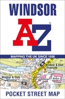 Stadsplattegrond Pocket Street Map Windsor | A-Z Map Company
Navigate your way around Windsor with detailed street maps from A-Z This up-to-date, folded A-Z street map includes all of the 1,500 streets in and around Windsor. Postcode districts, …
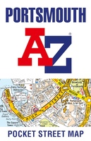 Stadsplattegrond Pocket Street Map Portsmouth | A-Z Map Company
Navigate your way around Portsmouth with detailed street maps from A-Z This up-to-date detailed, folded A-Z street map includes more than 2000 streets in and around Portsmouth. As well as …
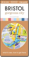 Stadsplattegrond Bristol | Quickmap
Get to know Bristol like a local with area flavours. See all the attractions inside and surrounding the city including Bath and find easy ways to get to them without …
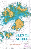 Reisverhaal Isles of Scilly | Ruud Offermans
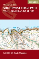 Wandelgids South West Coast Path Map Booklet | Cicerone
A booklet of all the mapping needed to walk the South West Coast Path between Minehead and St Ives. Covering the northern section of this 1014km (630 mile) National Trail …
 Wandelkaart South West Coast Path 2 | Harvey Maps★★★★★
Laatste reviews

Kan de huidige ontstuimige ontwikkelingen wereldwijd, nu ook geografisch plaatsen en daarmee beter volgen.
★★★★★ door Leo Janssen 20 december 2024 | Heeft dit artikel gekocht
We hadden Piëmonte al eens bezocht en voor onze komende reis werd ons door kennissen deze gids aanbevolen. Inderdaad is dit een heel goede gids. …
★★★★★ door DWKdB 19 december 2024 | Heeft dit artikel gekocht
Mijn bestellingen zijn altijd goed en worden altijd op tijd geleverd. Komen afspraken goed na. Erg tevreden.
★★★★★ door Ben Wegdam 19 december 2024 | Heeft dit artikel gekocht
Zeer gedetailleerde kaart van het zuidelijke deel van het douaniers pad
★★★★★ door Marian 18 december 2024 | Heeft dit artikel gekocht

