Wandelkaarten - Europa
 Wandelkaart North York Moors West | Harvey Maps
Covers a large area yet is handily compact. Pocket perfect! Detailed map for runners and walkers of the western section of the North York Moors National Park at the …
 Wandelkaart Pentland Hills | Harvey Maps
Covers a large area yet is handily compact. Pocket perfect!Detailed map for runners and walkers of the whole of the Pentlands at the magic scale of 1:40,000 on one side …
 Wandelkaart Arrochar Alps | Harvey Maps
Covers a large area yet is handily compact. Pocket perfect! Includes Beinn Ime, Ben Vorlich and the Cobbler (Ben Arthur). Detailed map for hillwalkers of the western part …
 Wandelkaart Ben Lawers & Schiehallion | Harvey Maps
40 years’ experience have gone into HARVEY’s most creative new series. Slim and light, the Ultramap covers a large area and yet is handily compact. Pocket perfect! Includes Ben …
 Wandelkaart Cairn Gorm & Ben Avon | Harvey Maps
40 years’ experience have gone into HARVEY’s most creative new series. Slim and light, the Ultramap covers a large area and yet is handily compact. Pocket perfect! Includes Cairn …
 Wandelkaart 07 Maintal-Odenwald | Geo-Naturpark Bergstraße-Odenwald
Gedetailleerde wandelkaart van dit gebied. Freizeitkarte im Detailmaßstab 1:20.000 mit allen Wanderwegen und den in der Natur beschilderten Radwanderwegen. Mit dem zertifizierten Premiumwanderweg Nibelungensteig sowie den Qualitätswegen und den …
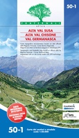
 Wandelkaart 50-1 Alta Val Susa - Alta Val Chisone - Val Germanasca | Fraternali Editore
Goede duidelijke wandelkaart van het gebiedAlta Val Susa - Alta Val Chisone - Val Germanasca Waterdicht en scheurvast. Voor de totstandkoming van deze papieren kaart zijn honderden kilometers over …
 Wandelkaart Loch Monar | Harvey Maps
40 years’ experience have gone into HARVEY’s most creative new series. Slim and light, the Ultramap covers a large area and yet is handily compact. Pocket perfect! The Ultramap …
 Wandelkaart Ochil Hills | Harvey Maps
Pocket perfect! Well known hills are Dumyat, Ben Cleuch and Castle Craig Hill. Magnificent views over the Forth Valley. Places of interest and enlargements of the steep and narrow glens: …
 Wandelkaart Suilven / Stac Pollaidh / Lochinver | Harvey Maps
Detailed map for runners and walkers of Suilven and the surrounding area at the magic scale of 1:40,000. Covers a large area yet is handily compact. Pocket perfect! This is …
 Wandelkaart Torridon | Harvey Maps
Covers a large area yet is handily compact. Pocket perfect!Includes Slioch, Beinn Eighe, Liathach and Beinn Alligin.Detailed map for runners and walkers of the Torridon Hills at the magic scale …
 Wandelkaart Trossachs Noord | Harvey Maps
Covers a large area yet is handily compact. Pocket perfect! Detailed map for runners and walkers of the northern section of the Trossachs National Park at the magic scale …
 Wandelkaart Yorkshire Dales Noord Oost | Harvey Maps
Covers a large area yet is handily compact. Pocket perfect! Detailed map for runners and walkers of the north eastern part of the Yorkshire Dales National Park at the …
 Wandelkaart Yorkshire Dales Noord West | Harvey Maps
Covers a large area yet is handily compact. Pocket perfect! Detailed map for runners and walkers of the north western part of the Yorkshire Dales National Park at the …
 Wandelkaart Arran | Harvey Maps
Covers a large area yet is handily compact. Pocket perfect! Features the renowned Goat Fell, A'Chir ridge, Beinn Bharrain, Glen Sannox & Glen Rosa. Detailed map for runners …
 Wandelkaart Glen Coe | Harvey Maps
Covers a large area yet is handily compact. Pocket perfect! Detailed map for runners and walkers of Glen Coe and the Aonach Eagach ridge at the magic scale of …
 Wandelkaart Loch Earn | Harvey Maps
Covers a large area yet is handily compact. Pocket perfect! Detailed map for runners and walkers of Loch Earn, Glen Ogle and Killin at the magic scale of 1:40,000. …
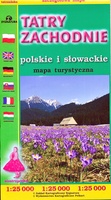
 Wandelkaart Tatry Zachodnie | Sygnatura
Goede wandelkaart van het grote westelijke deel van het Tatra gebergte, zowel aan de Poolse als aan de SLowaakse kant. Wandelpaden, campings, hutten, alles staat er op. Western Tatra Mountains …
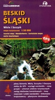
 Wandelkaart Beskid Slaski - Wista en Szczyrk - Beskiden | Sygnatura
De kaart beslaat de hele Silezische Beskiden, van Bielsko-Biała tot Zwardoń en van de Shelter bij Tułem tot Kotlina Żywiecka. Vertaling van Google Translate: De legende bevat ongeveer …
 Wandelkaart Yorkshire Dales Zuid Oost | Harvey Maps
HARVEY launch innovative new series: Ultramap XT40. 16 titles featuring in Trail magazine through spring 2016. 40 years experience have gone into HARVEY's most creative new series. The Ultramap covers …
Laatste reviews

zeer goede reisgids over saoudi-arabië gedetailleerd en gevarieerd de zwerver heeft super geleverd in België. goede ervaring met de zwerver! Frank De Witte
★★★★★ door De Witte Frank 29 november 2024 | Heeft dit artikel gekocht
Dit is echt een super product. Ik heb het getest door me aan te melden met mijn ID voorzien van Passprotect bij een ziekenhuis bezoek. …
★★★★★ door Jos Knoben 28 november 2024 | Heeft dit artikel gekocht
Ik heb al eerder topo kaarten besteld bij de zwerver. Deze worden altijd snel bezorg in top conditie, zeer tevreden.
★★★★★ door Jos knoben 28 november 2024 | Heeft dit artikel gekocht
Ja, zeer tevreden ! Ook de snelle verzending ! Blijf een trouwe klant van jullie.
★★★★★ door Jan de Jong 28 november 2024 | Heeft dit artikel gekocht

