Wegenatlas Western Australia 4WD Track atlas | A4 | Ringband | Hema Maps (9781922668875)
- ISBN / CODE: 9781922668875
- Editie: 15-02-2024
- Druk: 4
- Aantal blz.: 212
- Uitgever: Hema Maps
- Soort: Wegenatlas
- Taal: Engels
- Hoogte: 29.0 cm
- Breedte: 23.0 cm
- Bindwijze: -
- Uitvoering: Papier
- Beoordeling: 5,0 ★★★★★ (1 review) Schrijf een review
-
€ 43,95
Dit artikel is (tijdelijk) niet leverbaar


Beschrijving
Van de uitgever
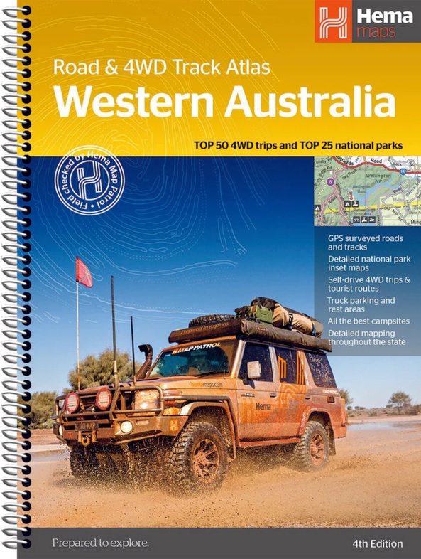
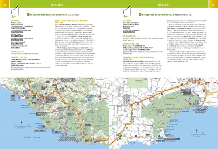
Western Australia Road & 4WD Track Atlas (4th Edition) - Discover Australia's largest state with the Western Australia Road & 4WD Track Atlas which includes a detailed atlas of the full State plus coverage of WA's top 25 national parks and 50 top 4WD trips.
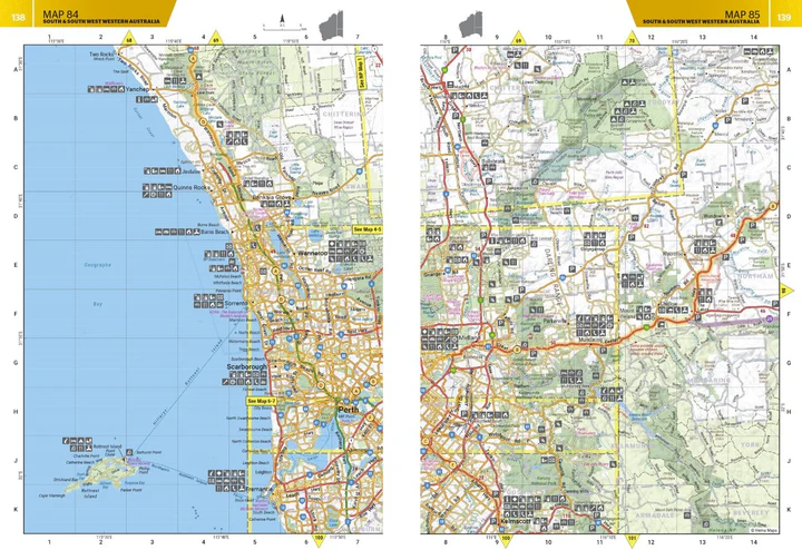
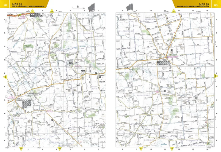
Embark on a grand exploration of Australia's largest state with the Hema Maps ‘Western Australia Road & 4WD Track Atlas’. This comprehensive guide is your key to planning and navigating an unforgettable journey through Western Australia (WA), offering state-wide atlas mapping that spans the entire State.
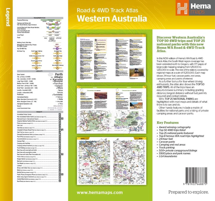
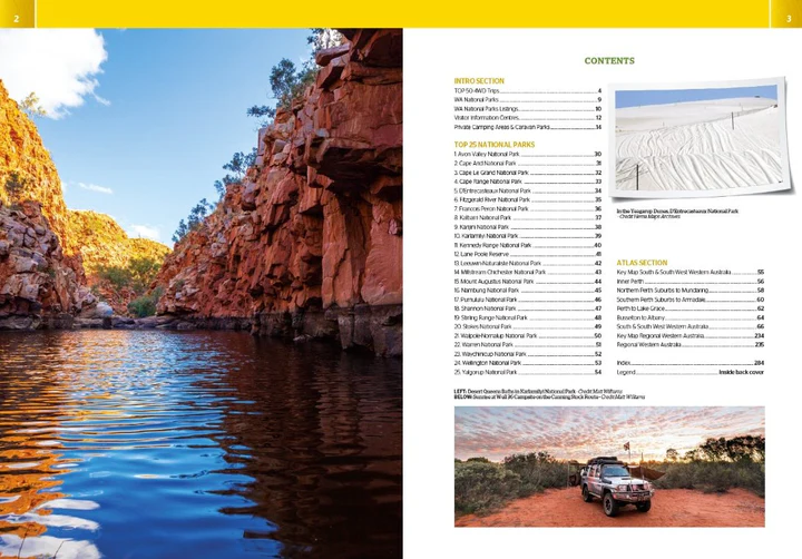
This atlas unveils the topography of the region, providing detailed coverage for precise navigation. Discover adventure with the Top 50 4WD Trips, each accompanied by track grading, distances, contact information, and an atlas reference. Immerse yourself in the natural beauty of Western Australia's Top 25 National Parks, where you'll find detailed information, including camping areas, activities, contact details, inset maps, and unique features that make each park special.
This atlas goes beyond the beaten path, offering insights into private camping areas and caravan parks, ensuring you have a range of accommodation options. An index and a list of accredited visitor centres within Western Australia add to the practicality of this guide. Whether you're a seasoned 4WD enthusiast or a traveler seeking to uncover the wonders of Western Australia, this atlas is your comprehensive companion for an enriching and well-guided adventure.
Key Features:
- Top 50 4WD Trips
- Top 25 WA National Parks
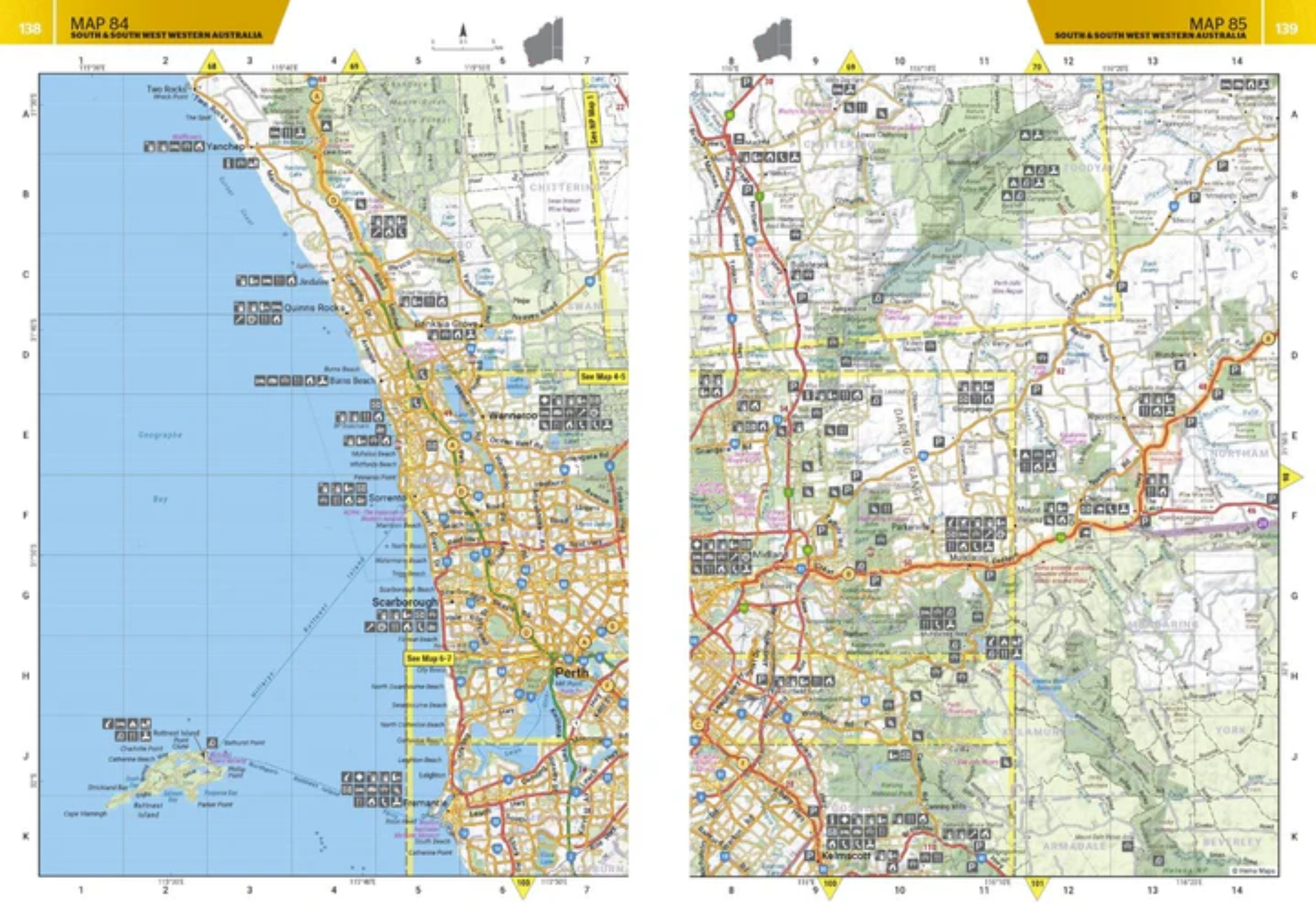
- Detailed mapping throughout the State (1:250,000)
- Caravan parks & dump points
- Camping and rest areas
- Truck Parking
- Visitor Centres
Reviews
De atlas geeft de noodzakelijke wegeninformatie op een gedetailleerde schaal, zodat je je goed kunt oriënteren op de vaak lange, soms saaie trajecten. Betrouwbare gegevens over noodzakelijke voorzieningen als tankstations en overnachtingsmogelijkheden. Veel nuttige en leuke toeristische informatie. Ben blij dat ik hem heb.
★★★★★ door D. Van der Maas 1 mei 2024 | Heeft dit artikel gekochtVond u dit een nuttige review? (login om te beoordelen)
Schrijf een review
Graag horen wij wat u van dit artikel vindt. Vindt u het goed, leuk, mooi, slecht, lelijk, onbruikbaar of erg handig: schrijf gerust alles op! Het is niet alleen leuk om te doen maar u informeert andere klanten er ook nog mee!
Ook interessant voor oceanie/australie/westernaustraliawestaustralie
-

Reisgids Pocket Perth - Fremantle |
€ 12,95Reisgidsen Western Australia - West Australië -

Wegenkaart - landkaart Explorer Map
€ 15,95Wegenkaarten South Australia - Zuid Australië -

Wegenkaart - landkaart Iconic Map Th
€ 15,95Wegenkaarten Northern Territories - Noord Australië -

Wegenatlas - Campinggids 4WD + Campi
€ 34,95Campinggidsen Western Australia - West Australië -

Wegenatlas The Kimberley Atlas & Gui
€ 47,50Wegenatlassen Northern Territories - Noord Australië