Wegenkaart - landkaart Prince Edward Eiland | ITMB (9781771296328)

- ISBN / CODE: 9781771296328
- Editie: 01-02-2024
- Druk: 3
- Aantal blz.: 1
- Schaal: 1:50000
- Uitgever: ITMB
- Soort: Wegenkaart
- Taal: Engels
- Hoogte: 25.0 cm
- Breedte: 10.0 cm
- Gewicht: 56.0 g
- Bindwijze: -
- Uitvoering: Papier
- Beoordeling: 4,0 ★★★★★ (1 review) Schrijf een review
-
€ 12,95
Leverbaar in 3 - 5 werkdagen in huis in Nederland Levertijd Belgie
Gratis verzending in Nederland vanaf €35,-


Beschrijving
Van de uitgever
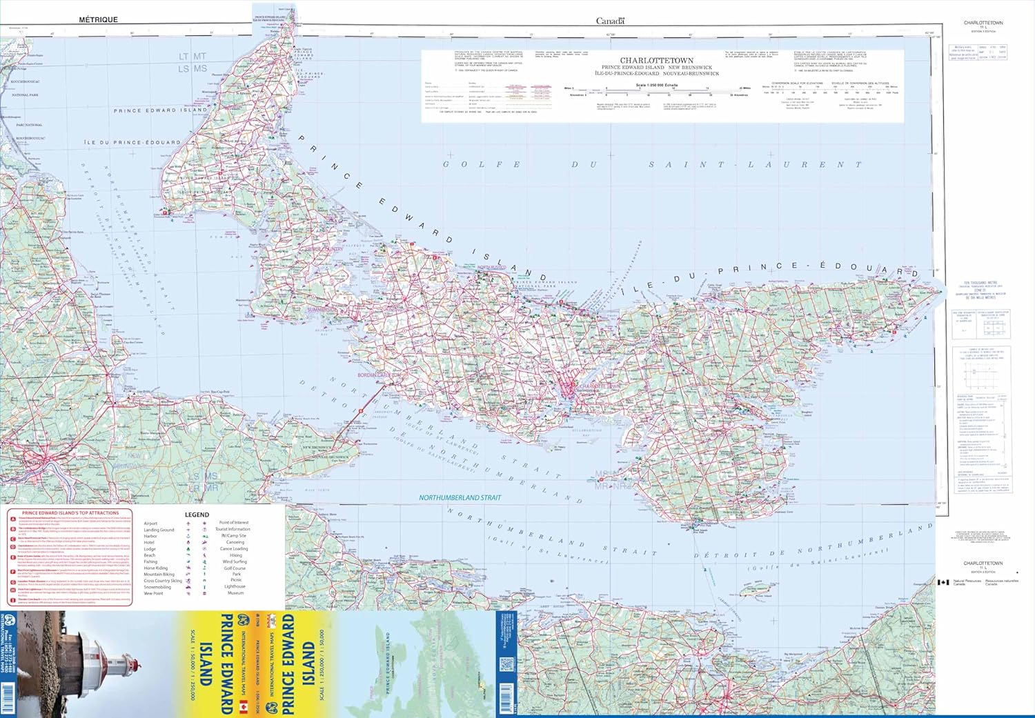
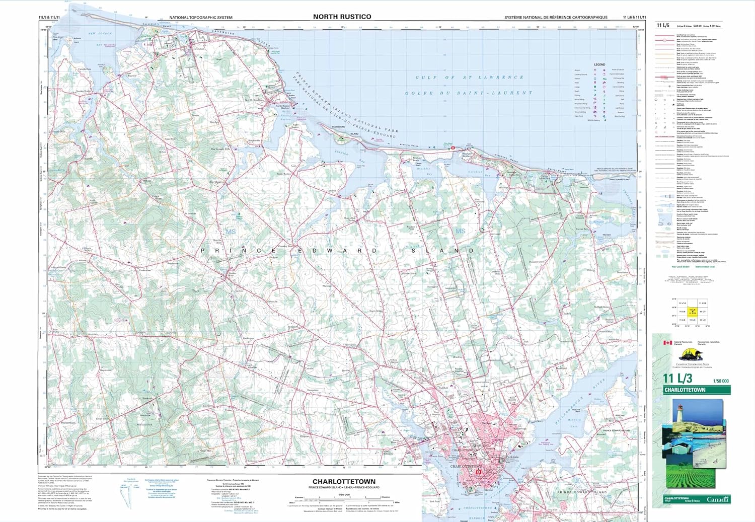
Wegenkaart Prince Edward EilandOn one side is Prince Edward Island, including the nearby coast of New Brunswick and Nova Scotia. The island’s road network is shown on a contoured topographic base with colouring/graphics for different type of terrain and land cover.
On the reverse is a topographic map of the central part of the island, north of Charlottetown. On both sides the publishers’ overprint highlight various types of accommodation including hotels, motels, lodges, campsites and RV grounds; tourist information centres; locations for recreational activities including fishing, horse riding, wind surfing etc. The map is printed on paper.
Reviews
Kaart is goed, maar had mij in verband met de oriëntatie iets anders voorgesteld. Ook meer autowegen omdat mijn vrouw niet ver kan lopen,
★★★★★ door Jan Maat 2 oktober 2018 | Heeft dit artikel gekochtVond u dit een nuttige review? (login om te beoordelen)
Schrijf een review
Graag horen wij wat u van dit artikel vindt. Vindt u het goed, leuk, mooi, slecht, lelijk, onbruikbaar of erg handig: schrijf gerust alles op! Het is niet alleen leuk om te doen maar u informeert andere klanten er ook nog mee!
Ook interessant voor noord-amerika/canada/prins-edwardeiland


