Wegenkaart - landkaart Nunavut | ITMB (9781553418450)
- ISBN / CODE: 9781553418450
- Editie: 24-04-2009
- Druk: 1
- Aantal blz.: 1
- Schaal: 1:1850000
- Uitgever: ITMB
- Soort: Wegenkaart
- Taal: Engels
- Hoogte: 25.0 cm
- Breedte: 10.0 cm
- Gewicht: 52.0 g
- Bindwijze: -
- Uitvoering: Papier
- Schrijf als eerste een review
-
€ 12,95
Leverbaar in 3 - 5 werkdagen in huis in Nederland Levertijd Belgie
Gratis verzending in Nederland vanaf €35,-
Beschrijving
Van de uitgever
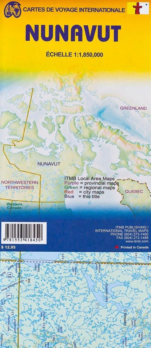
Wegenkaart NunavutTopography presented by altitude colouring rather than by relief shading. The map divides the province north/south with Baffin Island shown as inset. Coverage extends north to include all of Ellesmere Island in the Queen Elizabeth Islands archipelago.
In the absence of roads and with few settlements, topography is the main feature of the map. Altitude colouring and spot heights are in feet, with additional graphics for glaciers, swamps, salt flats, tundra etc. Many rivers and numerous lakes are named, with only a small selection of them included in the map index. Protected areas are highlighted.
Settlements and their airports are marked and the map also highlights the course of the Northwest Passage.
In addition to the large inset covering Baffin Island, three small insets cover smaller groups of islands: Akimiski and Charlton, Mansel and Ottawa, plus Charles and Akpatok. The map also includes brief notes on the province, e.g. total number of communities 28, of which Iqaluit is the largest, etc.
Reviews
Geen reviews gevonden voor dit product.
Schrijf een review
Graag horen wij wat u van dit artikel vindt. Vindt u het goed, leuk, mooi, slecht, lelijk, onbruikbaar of erg handig: schrijf gerust alles op! Het is niet alleen leuk om te doen maar u informeert andere klanten er ook nog mee!
Ook interessant voor noord-amerika/canada/nunavut


