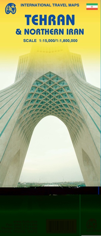
Stadsplattegrond Teheran Tehran & Northern Iran | ITMB (9781553417316)
- ISBN / CODE: 9781553417316
- Editie: 23-04-2009
- Druk: 1
- Aantal blz.: 1
- Schaal: 1:15000
- Uitgever: ITMB
- Soort: Stadsplattegrond
- Taal: Engels
- Hoogte: 25.0 cm
- Breedte: 10.0 cm
- Gewicht: 46.0 g
- Uitvoering: Papier
- Schrijf als eerste een review
-
€ 13,95
Dit artikel is (tijdelijk) niet leverbaar
Beschrijving
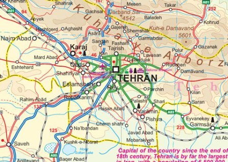
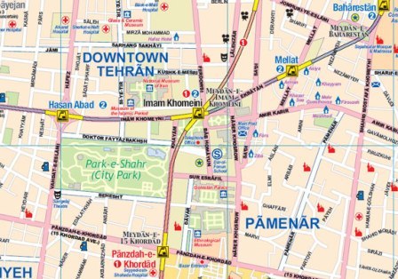
Een degelijke kaart met aanduidingen van o.a. nationale parken, vliegveld, benzinepomp, dirt-roads en kleine plattegrond van hoofdstad. Als overzichtskaart goed te gebruiken.
For years, Iran has been vilified as a threat to world peace, a supplier of arms to fuel insurrections around the world, and an ‘enemy’ rogue state. Is it? This is a cultured and educated society that has its faults, but I suspect that much of its militancy is contrived and encouraged by a militant few to maintain their grip on power. Tehran is a huge urban area, modernizing and changing with each passing year, building subways and expressways, hotels, and schools. This is the first map of the city published outside of the country, and I think our team of researchers has created a lovely piece of artwork that can only get better as time passes. We have also updated and printed a very detailed sectional map of the northern half of Iran on the reverse side.
Reviews
Geen reviews gevonden voor dit product.
Schrijf een review
Graag horen wij wat u van dit artikel vindt. Vindt u het goed, leuk, mooi, slecht, lelijk, onbruikbaar of erg handig: schrijf gerust alles op! Het is niet alleen leuk om te doen maar u informeert andere klanten er ook nog mee!
Ook interessant voor midden-oosten/iran
-

Woordenboek Visual Dictionary Arabic
€ 12,50Woordenboeken & Taalgidsen Abu Dhabi -

Wegenatlas Travel Atlas Silk Road -
€ 16,50Wegenatlassen China -

Reisgids Iran | Bradt Travel Guides
€ 24,95Reisgidsen Iran -

Wegenkaart - landkaart Iran | Freyta
€ 14,95Wegenkaarten Iran -

Vogelgids Birds of the Middle East -
€ 24,95Vogelgidsen Abu Dhabi