Wandelgidsen - Schotse Hooglanden & Speyside
 Wandelgids 007 Pathfinder Guides Fort William & Glen Coe | Ordnance Survey
Wandelgids van een deel Schotland. Deze gids bevat 28 dagwandelingen, variërend van korte tochten tot pittige dagtochten. De bijbehorende kaarten zijn uitstekend: men heeft de topografische kaarten van Ordnance Survey …
★★★★★★★★★★ Wandelgids 004 Pathfinder Guides Cairngorms | Ordnance Survey
Wandelgids van een deel van Engeland, Schotland of Wales. Deze gids bevat 28 dagwandelingen, variërend van korte tochten tot pittige dagtochten. De bijbehorende kaarten zijn uitstekend: men heeft de topografische …
★★★★★ Wandelgids 046 Pathfinder Guides Aberdeen & Royal Deeside | Ordnance Survey
Wandelgids van een deel van Schotland. Deze gids bevat 28 dagwandelingen, variërend van korte tochten tot pittige dagtochten. De bijbehorende kaarten zijn uitstekend: men heeft de topografische kaarten van Ordnance …
 Wandelgids 031 Pathfinder Guides Oban, Mull & Kintyre | Ordnance Survey
Wandelgids van een deel van Schotland. Deze gids bevat 28 dagwandelingen, variërend van korte tochten tot pittige dagtochten. De bijbehorende kaarten zijn uitstekend: men heeft de topografische kaarten van Ordnance …
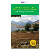 Wandelgids 023 Pathfinder Guides Loch Lomond , The Trossachs and Stirling | Ordnance Survey
Wandelgids van een deel van Engeland, Schotland of Wales. Deze gids bevat 28 dagwandelingen, variërend van korte tochten tot pittige dagtochten. De bijbehorende kaarten zijn uitstekend: men heeft de topografische …
★★★★★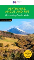 Wandelgids 027 Pathfinder Guides Perthshire, Angus & Fife | Ordnance Survey
Wandelgids van een deel van Engeland, Schotland of Wales. Deze gids bevat 28 dagwandelingen, variërend van korte tochten tot pittige dagtochten. De bijbehorende kaarten zijn uitstekend: men heeft de topografische …
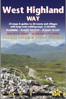 Wandelgids West Highland Way | Trailblazer Guides
All the information you need to enjoy your hiking adventure along the West Highland Way in this fully revised 8th edition. The West Highland Way passes through some of …
★★★★★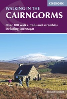 Wandelgids Walking in the Cairngorms | Cicerone
Uitstekende wandelgids, sommige meerdaags, voor dit uitdagende wandelgebied in Schotland. This guidebook contains over 100 routes for walking in the Scottish Cairngorms. It includes 18 Munro summits and smaller viewpoint …
★★★★★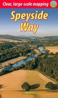 Wandelgids The Speyside Way | Rucksack Readers
Deze gids een goede beschrijving van de lange afstands route. De kaarten zijn schetsmatig maar wel duidelijk. The Speyside Way is one of Scotland’s Great Trails. It runs for 80 …
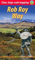 Wandelgids The Rob Roy Way | Rucksack Readers
Deze gids geeft een goede beschrijving van de lange afstands route. De kaarten zijn schetsmatig maar wel duidelijk. The Rob Roy Way is one of Scotland's Great Trails and is …
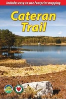 Wandelgids The Cateran Trail | Rucksack Readers
Uitgevoerd in de vorm van een klapper, met ringband geeft deze gids een goede beschrijving van de lange afstands route. De kaarten zijn schetsmatig maar wel duidelijk. The Cateran Trail …
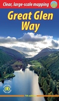 Wandelgids The Great Glen Way | Rucksack Readers
Uitgevoerd in de vorm van een klapper, met ringband geeft deze gids een goede beschrijving van de lange afstands route. De kaarten zijn schetsmatig maar wel duidelijk. The Great Glen …
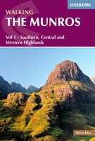 Wandelgids 1 Walking The Munros Vol 1 Southern, Central and Western Highlands - Schotland | Cicerone
Uitstekende wandelgids van het zuiden, midden en westen van de Schotse Hooglanden. Goed beschreven met veel praktische informatie om de route te kunnen lopen, inclusief redelijke kaarten. Guidebook to walking …
 Wandelgids West Highland Way | Rucksack Readers
Uitgevoerd in de vorm van een klapper, met ringband geeft deze gids een goede beschrijving van de lange afstands route. De kaarten zijn schetsmatig maar wel duidelijk. The West Highland …
★★★★★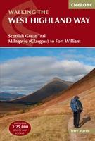 Wandelgids West Highland Way | Cicerone
Uitstekende wandelgids die in etappes de route nauwkeurig beschrijft; ook de zijtakken en alternatieve routes komen aan bod. Inclusief gidsje met topografische routekaarten van 1:25000 A guidebook to walking the …
★★★★★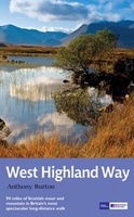 Wandelgids West Highland Way | Aurum Press
Gedegen routegids van het beroemdste pad van Schotland. Uitstekende kaarten, goede achtergronden, helaas wat beperkte praktische informatie. Engels. The 93-mile West Highland Way is indisputably Britain's most spectacular long-distance path. …
★★★★★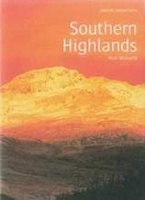 Wandelgids Southern Highlands | Pocket Mountains
Mooi uitgevoerde wandelgids in een handzaam formaat: 15 x 10 cm. De wandelingen zijn duidelijk beschreven, soms een beetje summier. This Pocket Mountains guide to the Southern Highlands of Scotland …
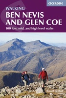 Wandelgids Ben Nevis and Glen Coe | Cicerone
Uitstekende wandelgids van Ben Nevis en Glen Coe. Goed beschreven met veel praktische informatie om de route te kunnen lopen, inclusief redelijke kaarten. This guidebook details 100 walking routes around …
★★★★★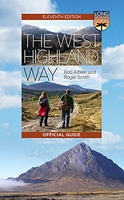 Wandelgids The West Highland Way | Birlinn
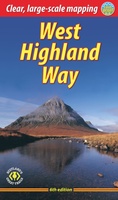
The West Highland Way Official Guide is de officiele gids met wandelroutekaart voor de meest beroemde lange afstandswandelroute door Schotland. Zeer handig is de bijgevoegde wandelkaart van Harvey. ‘If the …
★★★★★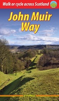 Wandelgids John Muir Way | Rucksack Readers
The John Muir Way runs for 134 miles (215 km) coast-to-coast across central Scotland, from Helensburgh on the Clyde to Dunbar on the North Sea. The route is as suitable …
- 1
- 2
- 3
- Volgende >>
- 4
Laatste reviews

De kaart is uitgevouwen zo'n 60 cm x 80 cm (2-zijdig). En daarop staat met een schaal van 1: 1.500.000 een kwart van India! Deze …
★★★★★ door Arjan 08 januari 2025 | Heeft dit artikel gekocht
Snelle en correctelevering van de kaart van Noorwegen. Een prachtige en overzichtelijke kaart die een goede indruk geeft van het landschap met hoogtelijnen.
★★★★★ door Hanneke van Dam 07 januari 2025 | Heeft dit artikel gekocht
Blij dat De Zwerver deze perfecte, franstalige IGN gidsen aanbiedt en dan óók met een woordenlijst erbij gevoegd. De voorbereiding kan beginnen na een vlotte …
★★★★★ door Lie van Schelven 06 januari 2025 | Heeft dit artikel gekocht
Voor een paar dagen Leipzig een prima reisgids. Het deel voor Dresden is aanmerkelijk groter maar was niet hinderlijk.
★★★★★ door J.A. Pazie 06 januari 2025 | Heeft dit artikel gekocht