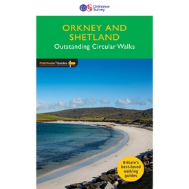
Wandelgids 082 Pathfinder Guides Orkney and Shetland | Ordnance Survey (9780319092088)
- ISBN / CODE: 9780319092088
- Editie: 13-06-2022
- Aantal blz.: 94
- Uitgever: Ordnance Survey
- Soort: Wandelgids
- Serie: Pathfinder Guides
- Taal: Engels
- Hoogte: 23.0 cm
- Breedte: 13.0 cm
- Dikte: 1.0 cm
- Gewicht: 207.0 g
- Bindwijze: Paperback
- Uitvoering: -
- Schrijf als eerste een review
-
€ 18,50
Op voorraad. Voor 17.00 uur op werkdagen besteld, morgen in huis in Nederland Levertijd Belgie
Gratis verzending in Nederland vanaf €35,-
-
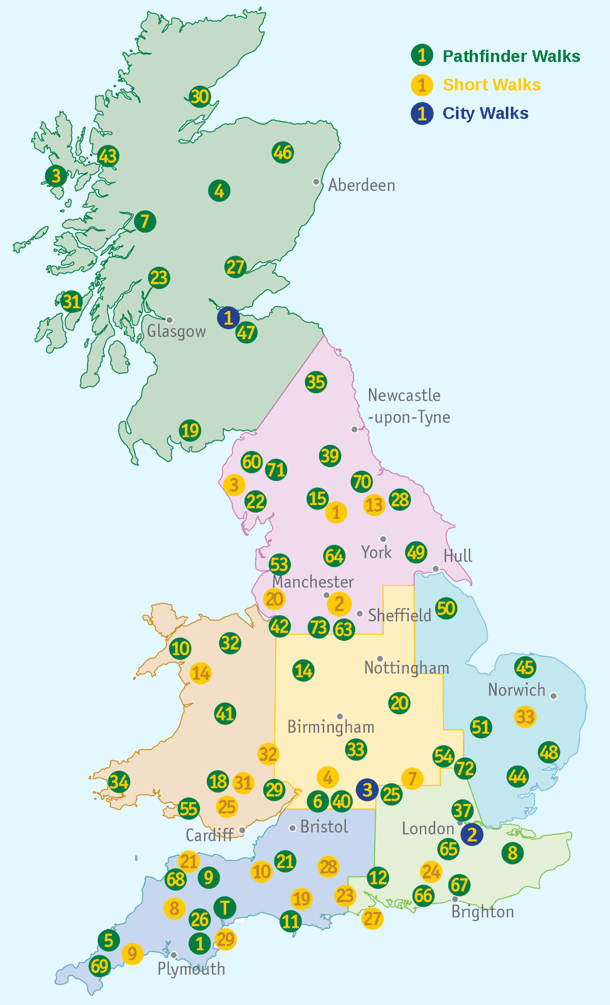
Overzicht Pathfinder Guides | Ordnance Survey


Producten op deze overzichtskaart:
Klik op een product om naar de pagina van dat product te gaan.
- Wandelgids 001 Pathfinder Guides South Devon & Dartmoor | Ordnance Survey
- Wandelgids 003 Pathfinder Guides Isle of Skye | Ordnance Survey
- Wandelgids 004 Pathfinder Guides Cairngorms | Ordnance Survey
- Wandelgids 005 Pathfinder Guides Cornwall | Ordnance Survey
- Wandelgids 006 Pathfinder Guides Cotswolds | Ordnance Survey
- Wandelgids 007 Pathfinder Guides Fort William & Glen Coe | Ordnance Survey
- Wandelgids 008 Pathfinder Short Walks Dartmoor | Ordnance Survey
- Wandelgids 008 Pathfinder Guides Kent | Ordnance Survey
- Wandelgids 009 Pathfinder Guides Exmoor & the Quantocks | Ordnance Survey
- Wandelgids 010 Pathfinder Guides Snowdonia | Ordnance Survey
- Wandelgids 011 Pathfinder Guides Dorset | Ordnance Survey
- Wandelgids 012 Pathfinder Guides New Forest, Hampshire and South Downs | Ordnance Survey
- Wandelgids 014 Pathfinder Short Walks Snowdonia | Ordnance Survey
- Wandelgids 015 Pathfinder Guides Yorkshire Dales | Ordnance Survey
- Wandelgids 018 Pathfinder Guides Brecon Beacons | Ordnance Survey
- Wandelgids 019 Pathfinder Guides Dumfries & Galloway | Ordnance Survey
- Wandelgids 020 Pathfinder Guides Sherwood Forest & the East Midlands | Ordnance Survey
- Wandelgids 023 Pathfinder Guides Loch Lomond , The Trossachs and Stirling | Ordnance Survey
- Wandelgids 025 Pathfinder Guides Thames Valley and Chilterns | Ordnance Survey
- Wandelgids 026 Pathfinder Guides Dartmoor | Ordnance Survey
- Wandelgids 027 Pathfinder Guides Perthshire, Angus & Fife | Ordnance Survey
- Wandelgids 028 Pathfinder Guides North York Moors | Ordnance Survey
- Wandelgids 029 Pathfinder Guides Wye Valley and Forest of Dean | Ordnance Survey
- Wandelgids 030 Pathfinder Guides Loch Ness and Inverness | Ordnance Survey
- Wandelgids 031 Pathfinder Short Walks Brecon Beacons | Ordnance Survey
- Wandelgids 031 Pathfinder Guides Oban, Mull & Kintyre | Ordnance Survey
- Wandelgids 034 Pathfinder Guides Pembrokeshire & Carmarthenshire | Ordnance Survey
- Wandelgids 039 Pathfinder Guides Durham, north Pennines and Tyne and Wear | Ordnance Survey
- Wandelgids 041 Pathfinder Guides Mid Wales | Ordnance Survey
- Wandelgids 042 Pathfinder Guides Cheshire | Ordnance Survey
- Wandelgids 044 Pathfinder Guides Essex | Ordnance Survey
- Wandelgids 045 Pathfinder Guides Norfolk | Ordnance Survey
- Wandelgids 046 Pathfinder Guides Aberdeen & Royal Deeside | Ordnance Survey
- Wandelgids 047 Pathfinder Guides Edinburgh, Pentlands & the Lothians | Ordnance Survey
- Wandelgids 048 Pathfinder Guides Suffolk | Ordnance Survey
- Wandelgids 049 Pathfinder Guides Vale of York and the Yorkshire Wolds | Ordnance Survey
- Wandelgids 050 Pathfinder Guides Pathfinder Lincolnshire & the Wolds | Ordnance Survey
- Wandelgids 051 Pathfinder Guides Cambridgeshire & the Fens | Ordnance Survey
- Wandelgids 053 Pathfinder Guides Lancashire | Ordnance Survey
- Wandelgids 054 Pathfinder Guides Hertfordshire and Bedfordshire | Ordnance Survey
- Wandelgids 055 Pathfinder Guides Gower, Swansea and Cardiff | Ordnance Survey
- Wandelgids 060 Pathfinder Guides Lake District | Ordnance Survey
- Wandelgids 063 Pathfinder Guides Peak District | Ordnance Survey
- Wandelgids 064 Pathfinder Guides South Pennines | Ordnance Survey
- Wandelgids 065 Pathfinder Guides Surrey | Ordnance Survey
- Wandelgids 066 Pathfinder Guides West Sussex and the South Downs National Park | Ordnance Survey
- Wandelgids 067 Pathfinder Guides South Downs National Park & East Sussex | Ordnance Survey
- Wandelgids 068 Pathfinder Guides North and Mid Devon | Ordnance Survey
- Wandelgids 069 Pathfinder Guides South West England's Coast | Ordnance Survey
- Wandelgids 071 Pathfinder Guides The High Fells of Lakeland | Ordnance Survey
- Wandelgids 072 Pathfinder Guides The Home Counties from London by Train | Ordnance Survey
- Wandelgids 073 Pathfinder Guides More Peak District | Ordnance Survey
- Wandelgids 074 Pathfinder Guides The Malverns to Warwickshire | Ordnance Survey
- Wandelgids 076 Pathfinder Guides Somerset & the Mendips | Ordnance Survey
- Wandelgids 077 Pathfinder Guides Wiltshire | Ordnance Survey
- Wandelgids 078 Pathfinder Guides Anglesey, Lleyn and Snowdonia | Ordnance Survey
- Wandelgids 079 Pathfinder Guides Dee Valley, Clwydian Hills and North East Wales | Ordnance Survey
- Wandelgids 080 Pathfinder Guides Shropshire | Ordnance Survey
- Wandelgids 081 Pathfinder Guides Staffordshire | Ordnance Survey
- Wandelgids 082 Pathfinder Guides Orkney and Shetland | Ordnance Survey
- Wandelgids 084 Pathfinder Guides Berkshire, Buckinghamshire and Oxfordshire | Ordnance Survey
- Wandelgids 087 Pathfinder Guides Northumberland | Ordnance Survey
Overzichtskaarten
Beschrijving
Wandelgids van een deel van Engeland. Deze gids bevat 28 dagwandelingen, variërend van korte tochten tot pittige dagtochten. De bijbehorende kaarten zijn uitstekend: men heeft de topografische kaarten van Ordnance Survey gebruikt waarop de route is ingetekend. Daarnaast praktische informatie over de wandeling en wat beschrijvingen van het gebied.
Reviews
Geen reviews gevonden voor dit product.
Schrijf een review
Graag horen wij wat u van dit artikel vindt. Vindt u het goed, leuk, mooi, slecht, lelijk, onbruikbaar of erg handig: schrijf gerust alles op! Het is niet alleen leuk om te doen maar u informeert andere klanten er ook nog mee!


