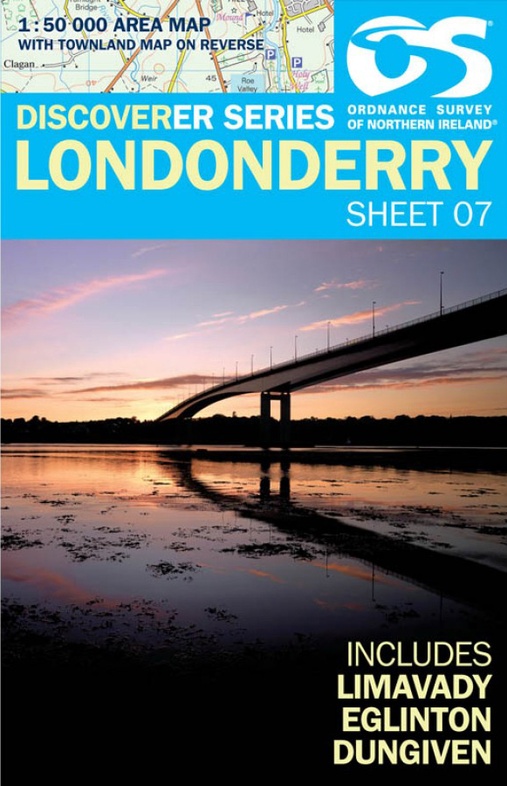
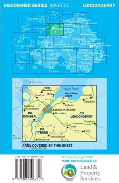
Wandelkaart 07 Discoverer Londonderry | Ordnance Survey Northern Ireland (9781905306961)
Ulster, Limavady, Eglington and Dungiven
- ISBN / CODE: 9781905306961
- Editie: 22-02-2018
- Aantal blz.: 1
- Schaal: 1:50000
- Uitgever: Ordnance Survey Northern Ireland
- Soort: Wandelkaart
- Serie: Discoverer
- Taal: Engels
- Hoogte: 18.0 cm
- Breedte: 11.0 cm
- Gewicht: 74.0 g
- Uitvoering: Papier
- Schrijf als eerste een review
-
€ 19,50
Op voorraad. Voor 17.00 uur op werkdagen besteld, morgen in huis in Nederland Levertijd Belgie
Gratis verzending in Nederland vanaf €35,-
-
Overzicht Wandelkaarten Noord Ierland Ordnance Survey 1:50000

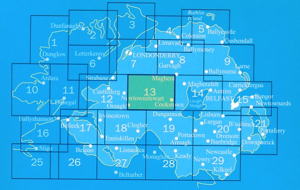
Producten op deze overzichtskaart:
Klik op een product om naar de pagina van dat product te gaan.
- Wandelkaart 04 Discoverer Coleraine | Ordnance Survey Northern Ireland
- Wandelkaart 05 Discoverer Ballycastle | Ordnance Survey Northern Ireland
- Wandelkaart 07 Discoverer Londonderry | Ordnance Survey Northern Ireland
- Wegenkaart - landkaart 08 Discoverer Ballymoney | Ordnance Survey
- Wandelkaart 09 Discoverer Larne | Ordnance Survey Northern Ireland
- Wandelkaart 12 Discoverer Strabane | Ordnance Survey Northern Ireland
- Wandelkaart 13 Discoverer The Sperrins | Ordnance Survey Northern Ireland
- Wandelkaart 14 Discoverer Lough Neagh | Ordnance Survey Northern Ireland
- Wandelkaart 17 Discoverer Lower Lough Erne | Ordnance Survey Northern Ireland
- Wandelkaart 18 Discoverer Enniskillen | Ordnance Survey Northern Ireland
- Wandelkaart 19 Discoverer Armagh | Ordnance Survey Northern Ireland
- Wandelkaart 20 Discoverer Craigavon | Ordnance Survey Northern Ireland
- Topografische kaart - Wandelkaart 21 Discovery Strangford Lough | Ordnance Survey Ireland
- Wandelkaart 26 Discoverer Lough Allen | Ordnance Survey Northern Ireland
- Wandelkaart 27 Discoverer Upper Lough Erne | Ordnance Survey Northern Ireland
- Wandelkaart 28 Discoverer Monaghan - Keady | Ordnance Survey Northern Ireland
- Wandelkaart 29 Discoverer The Mournes | Ordnance Survey Northern Ireland
Overzichtskaarten
Beschrijving
Reviews
Geen reviews gevonden voor dit product.
Schrijf een review
Graag horen wij wat u van dit artikel vindt. Vindt u het goed, leuk, mooi, slecht, lelijk, onbruikbaar of erg handig: schrijf gerust alles op! Het is niet alleen leuk om te doen maar u informeert andere klanten er ook nog mee!
Ook interessant voor europa/ierland
-

Wandkaart 20442 Groot Brittannië en
€ 21,95Wandkaarten van landen Engeland -

Wandelkaart 26 Discoverer Lough Alle
€ 19,50Wandelkaarten Killkenny - Waterford - Zuidoost Ierland -

Reisgids Ireland - Ierland | Lonely
€ 24,95Reisgidsen Ierland -

Stadsplattegrond Pocket Map Belfast
€ 7,95Stadsplattegronden Belfast -

Wandelgids Belfast Walks | O'Brien P
€ 13,50Wandelgidsen Belfast