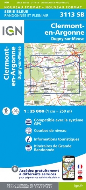
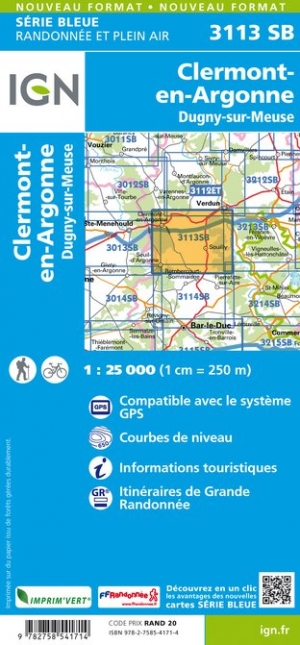
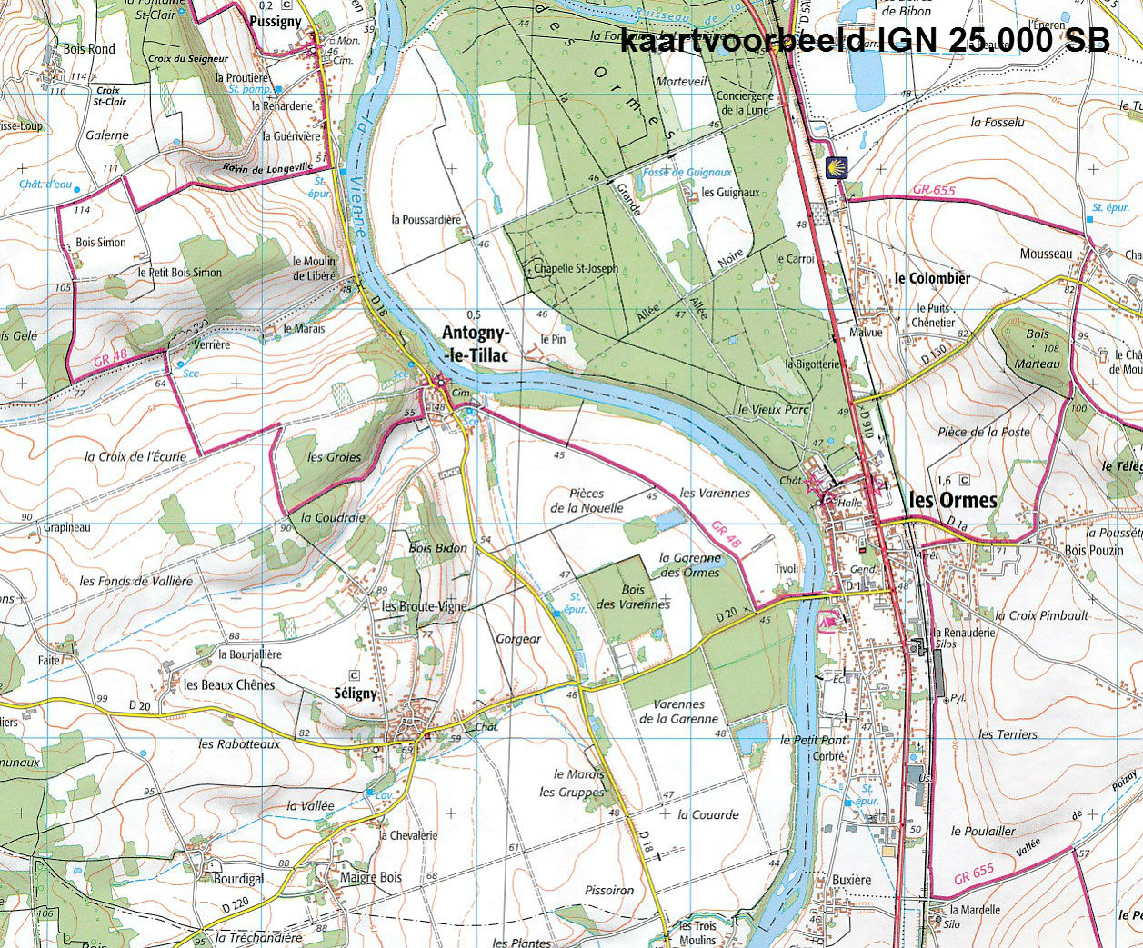
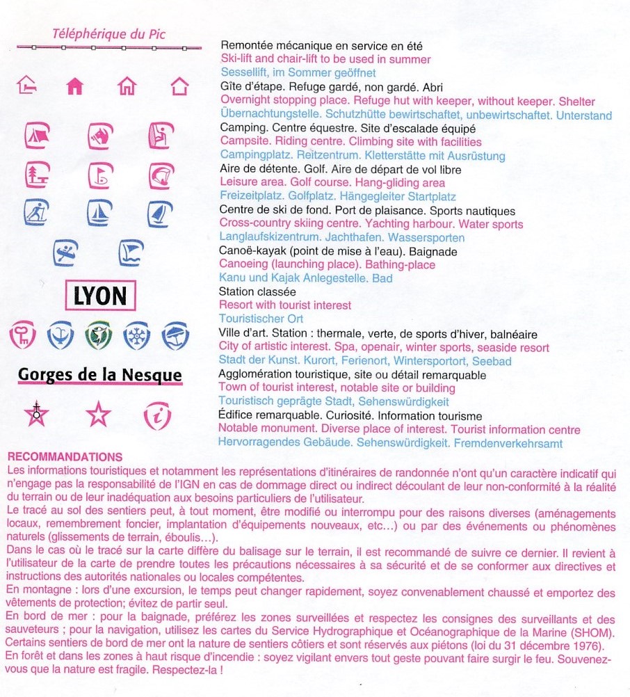
Wandelkaart - Topografische kaart 3113SB Clermont-en-Argonne | IGN - Institut Géographique National (9782758541714)
Dugny-sur-Meuse
- ISBN / CODE: 9782758541714
- Editie: meest recente versie
- Schaal: 1:25000
- Uitgever: IGN - Institut Géographique National
- Soort: Topografische kaart, Wandelkaart
- Serie: Serie bleue
- Taal: Frans
- Schrijf als eerste een review
-
€ 16,95
Leverbaar in 3 - 5 werkdagen in huis in Nederland Levertijd Belgie
Gratis verzending in Nederland vanaf €35,-
-
Topografische kaarten IGN 25.000 Champagne - Ardennen: Noord
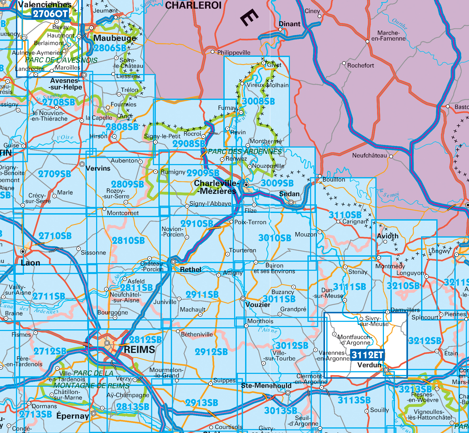
Producten op deze overzichtskaart:
Klik op een product om naar de pagina van dat product te gaan.
- Wandelkaart - Topografische kaart 2711SB Craonne - Beaurieux | IGN - Institut Géographique National
- Wandelkaart - Topografische kaart 2712SB Gueux - Fismes | IGN - Institut Géographique National
- Wandelkaart - Topografische kaart 2713SB Epernay - Dormans | IGN - Institut Géographique National
- Wandelkaart - Topografische kaart 2809SB Rozoy-sur-Serre - Aubenton | IGN - Institut Géographique National
- Wandelkaart - Topografische kaart 2810SB Château-Porcien, Dizy-le-Gros | IGN - Institut Géographique National
- Wandelkaart - Topografische kaart 2811SB Bazancourt - Guignicourt - Asfeld | IGN - Institut Géographique National
- Wandelkaart - Topografische kaart 2812SB Verzy - Reims | IGN - Institut Géographique National
- Wandelkaart - Topografische kaart 2813SB Epernay-Verzy | IGN - Institut Géographique National
- Wandelkaart - Topografische kaart 2908SB Revin, Rocroi, Maubert-Fontaine | IGN - Institut Géographique National
- Wandelkaart - Topografische kaart 2909SB Renwez-Signy, L'Abbaye | IGN - Institut Géographique National
- Wandelkaart - Topografische kaart 2910SB Rethel - Tourteron | IGN - Institut Géographique National
- Wandelkaart - Topografische kaart 2911SB Attigny | IGN - Institut Géographique National
- Wandelkaart - Topografische kaart 2912SB Mourmelon-le-Grand | IGN - Institut Géographique National
- Wandelkaart - Topografische kaart 2913SB Châlons-en-Champagne | IGN - Institut Géographique National
- Topografische kaart - Wandelkaart 3008SB Fumay | IGN - Institut Géographique National
- Wandelkaart - Topografische kaart 3009SB Charleville-Mézières | IGN - Institut Géographique National
- Wandelkaart - Topografische kaart 3010SB le Chesne | IGN - Institut Géographique National
- Wandelkaart - Topografische kaart 3011SB Vouziers | IGN - Institut Géographique National
- Topografische kaart - Wandelkaart 3012SB Varennes-en-Argonne | IGN - Institut Géographique National
- Wandelkaart - Topografische kaart 3013SB Ste-Menehould | IGN - Institut Géographique National
- Wandelkaart - Topografische kaart 3110SB Carignan | IGN - Institut Géographique National
- Wandelkaart - Topografische kaart 3111SB Stenay | IGN - Institut Géographique National
- Wandelkaart - Topografische kaart 3112ET Forêts de Verdun et du Mort-Homme | IGN - Institut Géographique National
- Wandelkaart - Topografische kaart 3113SB Clermont-en-Argonne | IGN - Institut Géographique National
- Wandelkaart - Topografische kaart 3213SB Vigneulles-lès-Hattonchâtel | IGN - Institut Géographique National
-
Wandelkaarten IGN 25.000 Champagne - Ardennen: Noord


Producten op deze overzichtskaart:
Klik op een product om naar de pagina van dat product te gaan.
- Wandelkaart - Topografische kaart 2711SB Craonne - Beaurieux | IGN - Institut Géographique National
- Wandelkaart - Topografische kaart 2712SB Gueux - Fismes | IGN - Institut Géographique National
- Wandelkaart - Topografische kaart 2713SB Epernay - Dormans | IGN - Institut Géographique National
- Wandelkaart - Topografische kaart 2809SB Rozoy-sur-Serre - Aubenton | IGN - Institut Géographique National
- Wandelkaart - Topografische kaart 2810SB Château-Porcien, Dizy-le-Gros | IGN - Institut Géographique National
- Wandelkaart - Topografische kaart 2811SB Bazancourt - Guignicourt - Asfeld | IGN - Institut Géographique National
- Wandelkaart - Topografische kaart 2812SB Verzy - Reims | IGN - Institut Géographique National
- Wandelkaart - Topografische kaart 2813SB Epernay-Verzy | IGN - Institut Géographique National
- Wandelkaart - Topografische kaart 2908SB Revin, Rocroi, Maubert-Fontaine | IGN - Institut Géographique National
- Wandelkaart - Topografische kaart 2909SB Renwez-Signy, L'Abbaye | IGN - Institut Géographique National
- Wandelkaart - Topografische kaart 2910SB Rethel - Tourteron | IGN - Institut Géographique National
- Wandelkaart - Topografische kaart 2911SB Attigny | IGN - Institut Géographique National
- Wandelkaart - Topografische kaart 2912SB Mourmelon-le-Grand | IGN - Institut Géographique National
- Wandelkaart - Topografische kaart 2913SB Châlons-en-Champagne | IGN - Institut Géographique National
- Topografische kaart - Wandelkaart 3008SB Fumay | IGN - Institut Géographique National
- Wandelkaart - Topografische kaart 3009SB Charleville-Mézières | IGN - Institut Géographique National
- Wandelkaart - Topografische kaart 3010SB le Chesne | IGN - Institut Géographique National
- Wandelkaart - Topografische kaart 3011SB Vouziers | IGN - Institut Géographique National
- Topografische kaart - Wandelkaart 3012SB Varennes-en-Argonne | IGN - Institut Géographique National
- Wandelkaart - Topografische kaart 3013SB Ste-Menehould | IGN - Institut Géographique National
- Wandelkaart - Topografische kaart 3110SB Carignan | IGN - Institut Géographique National
- Wandelkaart - Topografische kaart 3111SB Stenay | IGN - Institut Géographique National
- Wandelkaart - Topografische kaart 3112ET Forêts de Verdun et du Mort-Homme | IGN - Institut Géographique National
- Wandelkaart - Topografische kaart 3113SB Clermont-en-Argonne | IGN - Institut Géographique National
- Wandelkaart - Topografische kaart 3213SB Vigneulles-lès-Hattonchâtel | IGN - Institut Géographique National
Overzichtskaarten
Beschrijving
Reviews
Geen reviews gevonden voor dit product.
Schrijf een review
Graag horen wij wat u van dit artikel vindt. Vindt u het goed, leuk, mooi, slecht, lelijk, onbruikbaar of erg handig: schrijf gerust alles op! Het is niet alleen leuk om te doen maar u informeert andere klanten er ook nog mee!
Ook interessant voor europa/frankrijk/champagne-ardennen
-

Fietskaart - Wegenkaart - landkaart
€ 10,95Fietskaarten Champagne - Ardennen -

Historische Kaart Bataille de Verdun
€ 10,50Historische Kaarten Champagne - Ardennen -

Wandelgids 5500 Itinérances et rando
€ 19,95Wandelgidsen Champagne - Ardennen -

Wandelkaart - Topografische kaart 29
€ 16,95Topografische kaarten Champagne - Ardennen -

Reisgids Historische Route Verdun |
€ 16,99Reisgidsen Champagne - Ardennen