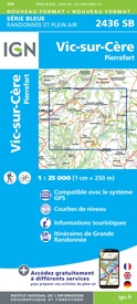
Wandelkaart - Topografische kaart 2436 SB - Serie Bleue Pierrefort, Barrage de Sarrans, Vic-sur-Cère | IGN - Institut Géographique National (9782758548638)
- ISBN / CODE: 9782758548638
- Editie: 09-09-2019
- Druk: 1
- Aantal blz.: 1
- Schaal: 1:25000
- Uitgever: IGN - Institut Géographique National
- Soort: Topografische kaart, Wandelkaart
- Serie: SB - Serie Bleue
- Taal: Engels, Frans
- Hoogte: 22.0 cm
- Breedte: 11.0 cm
- Gewicht: 94.0 g
- Uitvoering: Papier
- Beoordeling: 5,0 ★★★★★ (1 review) Schrijf een review
-
€ 16,95
Leverbaar in 3 - 5 werkdagen in huis in Nederland Levertijd Belgie
Gratis verzending in Nederland vanaf €35,-
-
Topografische kaarten IGN 25.000 Cantal en Auvergne : Zuid

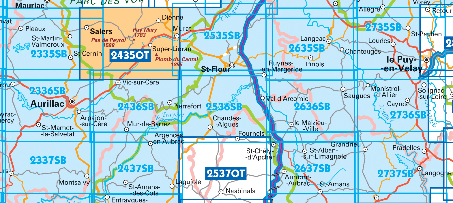
Producten op deze overzichtskaart:
Klik op een product om naar de pagina van dat product te gaan.
- Wandelkaart - Topografische kaart 2335 SB - Serie Bleue St-Cernin, Salers, Pleaux | IGN - Institut Géographique National
- Wandelkaart - Topografische kaart 2336 SB - Serie Bleue Aurillac, Barrage de St-Etienne-Cantalès, Laroquebrou | IGN - Institut Géographique National
- Wandelkaart - Topografische kaart 2337 SB - Serie Bleue Maurs | IGN - Institut Géographique National
- Wandelkaart - Topografische kaart 2435OT Monts du Cantal | IGN - Institut Géographique National
- Wandelkaart - Topografische kaart 2435OTR Monts du Cantal PNR des Volcans d'Auvergne | IGN - Institut Géographique National
- Wandelkaart - Topografische kaart 2436 SB - Serie Bleue Pierrefort, Barrage de Sarrans, Vic-sur-Cère | IGN - Institut Géographique National
- Wandelkaart - Topografische kaart 2437 SB - Serie Bleue Laguiole, Entraygues-sur-Truyere | IGN - Institut Géographique National
- Wandelkaart - Topografische kaart 2535 SB - Serie Bleue St-Flour, Murat | IGN - Institut Géographique National
- Wandelkaart - Topografische kaart 2536 SB - Serie Bleue Chaudes-Aigues, Gorges de la Truyère, Faverolles | IGN - Institut Géographique National
- Wandelkaart - Topografische kaart 2537OT Nasbinals - Monts d'Aubrac | IGN - Institut Géographique National
- Wandelkaart - Topografische kaart 2635 SB - Serie Bleue Langeac - Lavoûte-Chilhac | IGN - Institut Géographique National
- Wandelkaart - Topografische kaart 2636 SB - Serie Bleue Saugues | IGN - Institut Géographique National
- Wandelkaart - Topografische kaart 2637 SB - Serie Bleue Saint-Chély-d'Apcher | IGN - Institut Géographique National
- Wandelkaart - Topografische kaart 2735 SB - Serie Bleue Loudes, Le Puy-en-Velay | IGN - Institut Géographique National
- Wandelkaart - Topografische kaart 2736 SB - Serie Bleue Monistrol d'Allier, Solignac-sur-Loire, Cayres | IGN - Institut Géographique National
- Wandelkaart - Topografische kaart 2737 SB - Serie Bleue Langogne - Grandrieu | IGN - Institut Géographique National
-
Wandelkaarten IGN 25.000 Cantal en Auvergne : Zuid

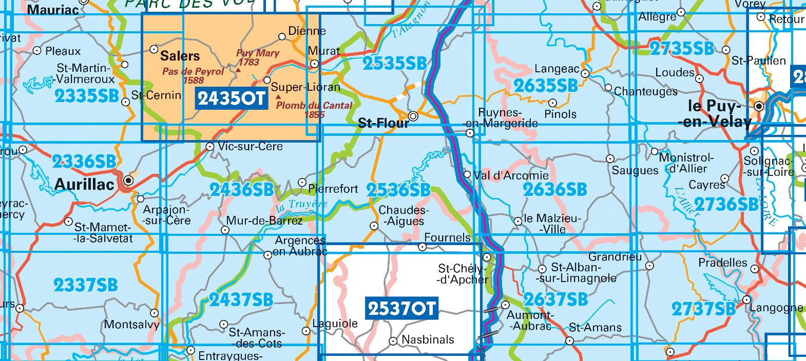
Producten op deze overzichtskaart:
Klik op een product om naar de pagina van dat product te gaan.
- Wandelkaart - Topografische kaart 2335 SB - Serie Bleue St-Cernin, Salers, Pleaux | IGN - Institut Géographique National
- Wandelkaart - Topografische kaart 2336 SB - Serie Bleue Aurillac, Barrage de St-Etienne-Cantalès, Laroquebrou | IGN - Institut Géographique National
- Wandelkaart - Topografische kaart 2337 SB - Serie Bleue Maurs | IGN - Institut Géographique National
- Wandelkaart - Topografische kaart 2435OT Monts du Cantal | IGN - Institut Géographique National
- Wandelkaart - Topografische kaart 2435OTR Monts du Cantal PNR des Volcans d'Auvergne | IGN - Institut Géographique National
- Wandelkaart - Topografische kaart 2436 SB - Serie Bleue Pierrefort, Barrage de Sarrans, Vic-sur-Cère | IGN - Institut Géographique National
- Wandelkaart - Topografische kaart 2437 SB - Serie Bleue Laguiole, Entraygues-sur-Truyere | IGN - Institut Géographique National
- Wandelkaart - Topografische kaart 2535 SB - Serie Bleue St-Flour, Murat | IGN - Institut Géographique National
- Wandelkaart - Topografische kaart 2536 SB - Serie Bleue Chaudes-Aigues, Gorges de la Truyère, Faverolles | IGN - Institut Géographique National
- Wandelkaart - Topografische kaart 2537OT Nasbinals - Monts d'Aubrac | IGN - Institut Géographique National
- Wandelkaart - Topografische kaart 2635 SB - Serie Bleue Langeac - Lavoûte-Chilhac | IGN - Institut Géographique National
- Wandelkaart - Topografische kaart 2636 SB - Serie Bleue Saugues | IGN - Institut Géographique National
- Wandelkaart - Topografische kaart 2637 SB - Serie Bleue Saint-Chély-d'Apcher | IGN - Institut Géographique National
- Wandelkaart - Topografische kaart 2735 SB - Serie Bleue Loudes, Le Puy-en-Velay | IGN - Institut Géographique National
- Wandelkaart - Topografische kaart 2736 SB - Serie Bleue Monistrol d'Allier, Solignac-sur-Loire, Cayres | IGN - Institut Géographique National
- Wandelkaart - Topografische kaart 2737 SB - Serie Bleue Langogne - Grandrieu | IGN - Institut Géographique National
Overzichtskaarten
Beschrijving
Reviews
Heerlijk voorbereiden en zekerheid wanneer je voor verassingen staat!
★★★★★ door Ben Demmer 6 augustus 2020 | Heeft dit artikel gekochtVond u dit een nuttige review? (login om te beoordelen)
Schrijf een review
Graag horen wij wat u van dit artikel vindt. Vindt u het goed, leuk, mooi, slecht, lelijk, onbruikbaar of erg handig: schrijf gerust alles op! Het is niet alleen leuk om te doen maar u informeert andere klanten er ook nog mee!

