Categorieën
- Nieuwe artikelen
- Boeken
-
Kaarten
- Camperkaarten
- Educatieve kaarten
- Fietskaarten
- Fietsknooppuntenkaarten
- Historische Kaarten
- Pelgrimsroutes (kaarten)
- Spoorwegenkaarten
- Stadsplattegronden
- Toerskikaarten
- Topografische kaarten
- Wandelatlassen
- Wandelkaarten
- Wandelknooppuntenkaarten
- Waterkaarten
- Wegenatlassen
-
Wegenkaarten
- Afrika
- Azië
-
Europa
- Albanië
- Andorra
- Armenië
- Azerbeidzjan
- Belarus - Witrusland
- België
- Bosnië - Hercegovina
- Bulgarije
- Cyprus
- Denemarken
- Duitsland
- Engeland
- Estland
- Faroer
- Finland
-
Frankrijk
- Picardie - Noordwest Frankrijk
- Hauts-de-France
- Grand-Est
- Champagne - Ardennen
- Normandië
- Bretagne
- Pays de la Loire
- Dordogne - Limousin
- Franse Atlantische Kust - Nouvelle-Aquitaine
- Aquitaine
- Limousin
- Poitou-Charentes
- Vogezen - Elzas - Lotharingen
- Île-de-France
- Bourgogne - Franche-Comté
- Franche-Comté
- Bourgondië
- Auvergne - Rhône-Alpes
- Auvergne
- Rhône-Alpes
- Franse Alpen
- Alpen - Mont Blanc - Haute Savoie
- Alpen - Vanoise - Savoie
- Alpen - Vaucluse - Drome - Vercors
- Pyreneeën
- Occitanie
- Languedoc - Rousillon
- Cevennen
- Midi-Pyrénées
- Centre - Val de Loire
- Provence - Alpes-Côte d’Azur
- Cote d'Azur - Franse Riviera
- Provence
- Corsica
- Lyon
- Parijs
- Rennes
- Straatsburg
- Georgië
- Griekenland
- Groenland
- Hongarije
- IJsland
- Ierland
- Italië
- Kosovo
- Kroatië
- Letland
- Liechtenstein
- Litouwen
- Luxemburg
- Malta
- Moldavië
- Monaco
- Montenegro
- Nederland
- Noord-Ierland
- Noord-Macedonië
- Noorwegen
- Oekraïne
- Oostenrijk
- Polen
- Portugal
- Roemenië
- Rusland
- Scandinavië
- Schotland
- Servië
- Slovenië
- Slowakije
- Spanje
- Tsjechië
- Turkije
- Vaticaanstad
- Zweden
- Zwitserland
- Midden-Amerika
- Midden-Oosten
- Noord-Amerika
- Oceanië
- Wereld
- Zuid-Amerika
- Wintersportkaarten
- Opruiming
- Puzzels
- Travel Gadgets
- Wandkaarten
- Wereldbollen
Veilig online betalen
Betaal veilig via uw eigen bankomgeving
- U bent hier:
- Home
- Europa
- Frankrijk
- Franse Atlantische Kust - Nouvelle-Aquitaine
- Kaarten
- Wegenkaarten
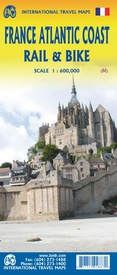
Wegenkaart - landkaart Frankrijk Atlantische kust | ITMB (9781771292887)
- ISBN / CODE: 9781771292887
- Editie: 22-01-2022
- Druk: 1
- Aantal blz.: 1
- Schaal: 1:600000
- Uitgever: ITMB
- Soort: Wegenkaart
- Taal: Engels
- Hoogte: 25.0 cm
- Breedte: 10.0 cm
- Gewicht: 54.0 g
- Uitvoering: Papier
- Bindwijze: -
- Schrijf als eerste een review
-
€ 14,50
Leverbaar in 3 - 5 werkdagen in huis in Belgie Levertijd Nederland Leverbaar in 3 - 5 werkdagen in huis in Nederland Levertijd Belgie
Gratis verzending in Nederland vanaf €35,-
- Afbeeldingen
- Inkijkexemplaar
Beschrijving
Van de uitgever
Wegenkaart Frankrijk Atlantische kust met aanduiding fietspaden en spoorwegen
France is a rather large country, and while it can be portrayed on a map as a country, mapping it in segments provides an opportunity to concentrate on regions at a better scale. This map, covering the coastal region of France from the Cotenin Peninsula south to the Spanish border and east as far as Paris and Montpellier in Languedoc is the first of what we hope will be a series covering the country at an improved scale. This map is double-sided, covering from Quimper and Paris at the northernmost portion of coverage, to Angouleme and Clermont at the southern extreme on one side, with the second side covering from Bordeaux and St-Etienne south to Bayonne/Pamplona and Nimes/Avignon in the south. This is a part of Europe that has been fought over for centuries, and as such is dotted with fortresses proclaiming its historic importance. This map has been designed with the leisure traveller in mind. Although it shows all motorways and highways, rail connections by train are emphasized, as are long-distance Euro-Velo cycling routes that are being developed in many parts of Europe. At this scale, it would be impractical to record all accommodations, but we have included a new feature that is thus far peculiar to France, and that is motorway hotels at rest areas. Naturally, the map is rich with places of touristic interest.
Legend Includes:
Roads by classification, Rivers and Lakes, National Park, Airports, Points of Interests, Highways, Main Roads, Zoos, Fishing, and much more...
Reviews
Geen reviews gevonden voor dit product.
Schrijf een review
Graag horen wij wat u van dit artikel vindt. Vindt u het goed, leuk, mooi, slecht, lelijk, onbruikbaar of erg handig: schrijf gerust alles op! Het is niet alleen leuk om te doen maar u informeert andere klanten er ook nog mee!
Ook interessant voor europa/frankrijk/atlantischekust
-

Wandelkaart - Topografische kaart 14
€ 16,95Topografische kaarten Gironde -

Reisgids Capitool Reisgidsen Dordogn
€ 28,99Reisgidsen Dordogne - Limousin -

Wandelgids 3300 Autour de Bordeaux |
€ 20,95Wandelgidsen Franse Atlantische Kust - Nouvelle-Aquitaine -

Wegenkaart - landkaart 10 Atlantisch
€ 12,99Wegenkaarten Franse Atlantische Kust - Nouvelle-Aquitaine -

Fietsgids Trotter de Loire per Fiets
€ 24,99Fietsgidsen Franse Atlantische Kust - Nouvelle-Aquitaine


