Wandelkaart 4009 Hadrian's Wall | National Geographic (9781566959421)
- ISBN / CODE: 9781566959421
- Editie: 01-09-2024
- Aantal blz.: 48
- Schaal: 1:25000
- Uitgever: National Geographic
- Soort: Wandelkaart
- Serie: Great Treks Topographic Map Guides
- Taal: Engels
- Hoogte: 24.0 cm
- Breedte: 11.0 cm
- Gewicht: 92.0 g
- Bindwijze: Paperback
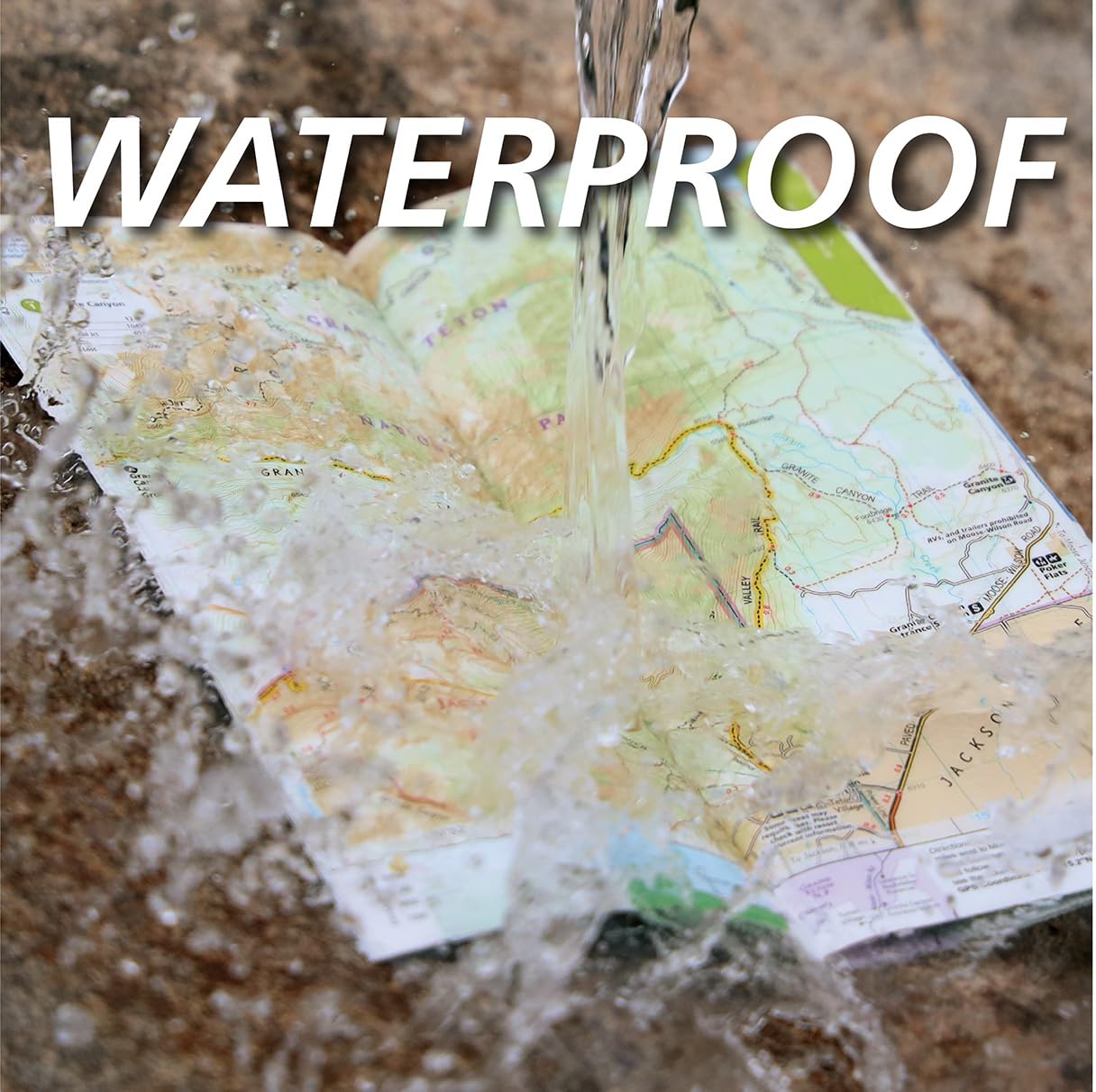
- Uitvoering: Scheur- en watervast
- Schrijf als eerste een review
-
€ 17,95
Leverbaar in 3 - 5 werkdagen in huis in Nederland Levertijd Belgie
Gratis verzending in Nederland vanaf €35,-
Beschrijving
Van de uitgever
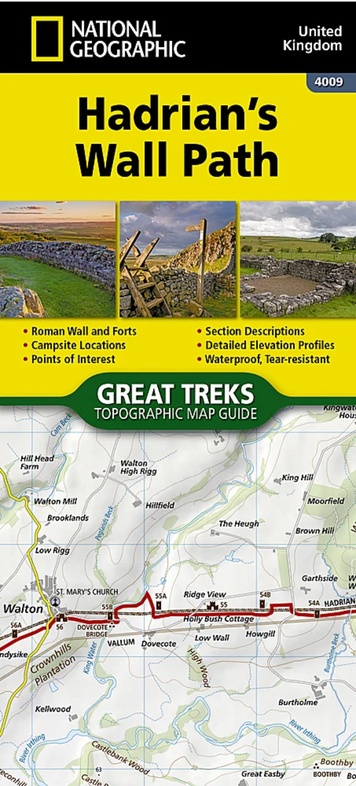
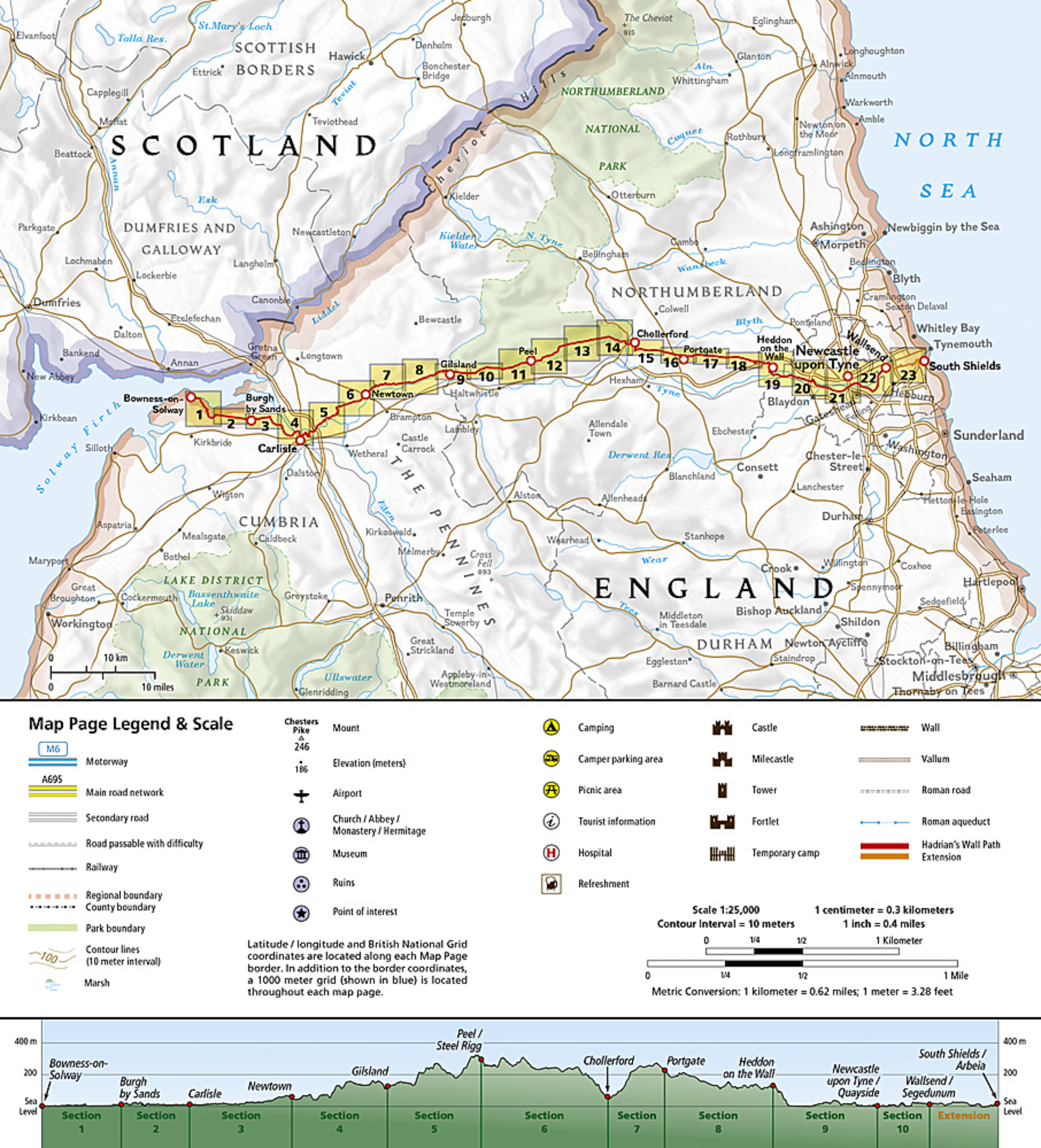
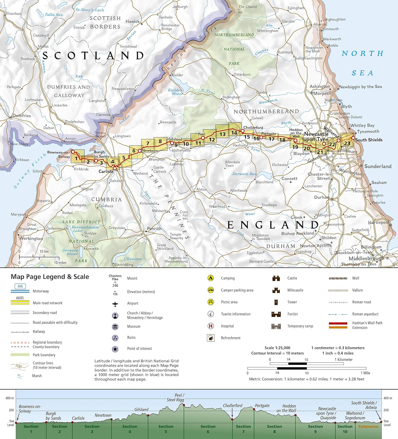
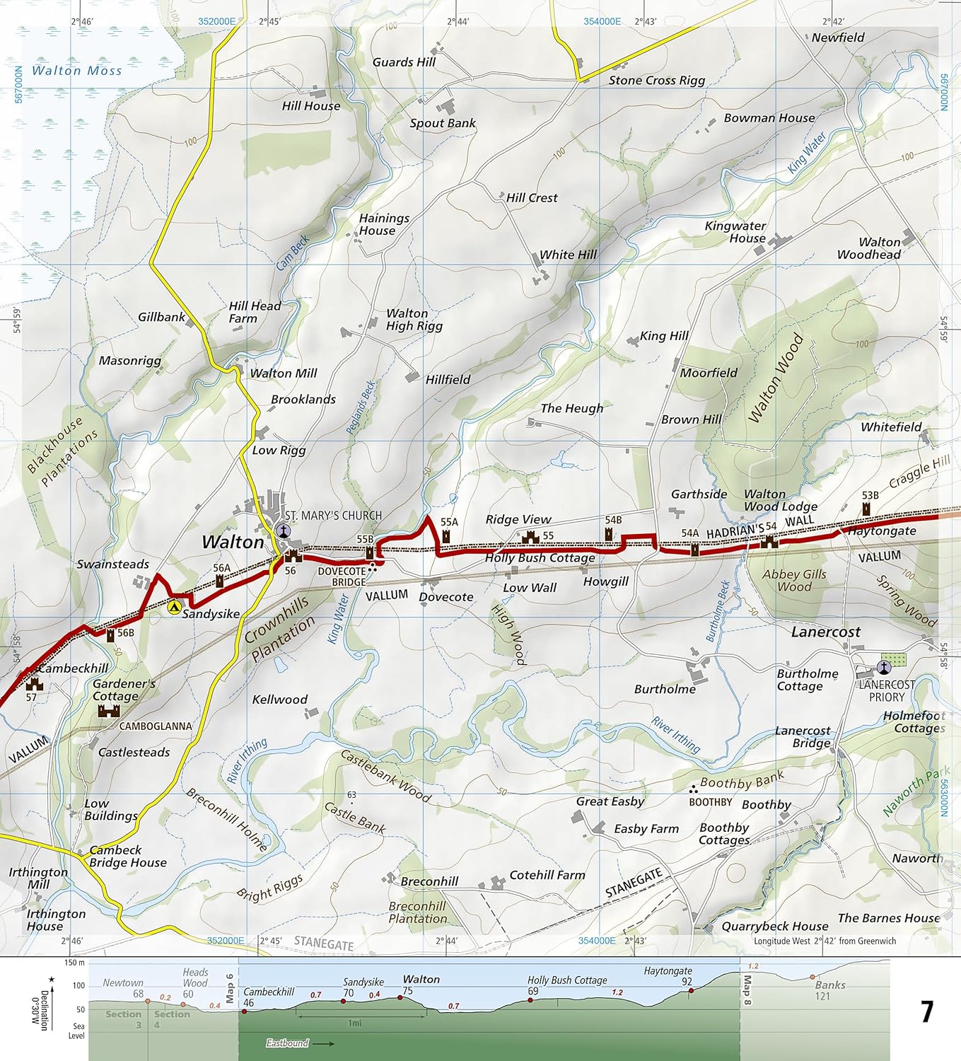
As a demonstration of the Roman Empire's power and strength, Emperor Hadrian conceived the idea to build a wall to deter attacks on his Roman territory Britannia. At the time — and even today — building a 73-mile (118-kilometer) long wall, standing 5 meters (16 feet) high and 3 meters (10 feet) wide was an exceptional undertaking. In a.d. 122, approximately 15,000 soldiers were enlisted to begin construction of this project, which included forts, turrets, bridges, milecastles, and the interconnecting wall.
Today, Hadrian's Wall is recognized as a UNESCO World Heritage Site. From Bowness-on-Solway to Wallsend, the 84-mile (135-kilometer) Hadrian’s Wall Path meanders the wild and scenic English countryside providing an opportunity to learn more about these historic sites.
The Hadrian's Wall Path Topographic Map Guide booklet makes a perfect traveling companion when traversing the route. A detailed description of each trail section is included that tells travelers about the many landmarks encountered along the way.
Every Great Treks map is printed on "Backcountry Tough" waterproof, tear-resistant paper. A full Lat/Long grid is printed on the map to aid with GPS navigation. Every map purchase helps support the National Geographic Society, an impact driven, nonprofit organization with global reach that uses the power of science, exploration, education, and storytelling to illuminate and protect the wonder of our world.
Reviews
Geen reviews gevonden voor dit product.
Schrijf een review
Graag horen wij wat u van dit artikel vindt. Vindt u het goed, leuk, mooi, slecht, lelijk, onbruikbaar of erg handig: schrijf gerust alles op! Het is niet alleen leuk om te doen maar u informeert andere klanten er ook nog mee!
Ook interessant voor europa/engeland/north-east-england
-

Campergids 96 nach England, der Nord
€ 21,95Campergidsen North East England -

Wandelgids Hadrian's Wall path | Ruc
€ 17,95Wandelgidsen North East England -

Fietsgids Hadrian's Cycleway | Cicer
€ 16,50Fietsgidsen North East England -

Wandelkaart Hadrian's Wall Path | Ve
€ 24,50Wandelkaarten 🥾 Hadrian's Wall Path -

Reisgids Trotter Noord-Engeland en W
€ 19,99Reisgidsen North East England