Winkelwagen
Main features
Fully revised and updated
Full index to place names (on reverse of sheet)
Distance chart giving distances in kilometres between main towns
European Union map showing member states and the Eurozone
Internet links to further information on Europe
Area of coverage
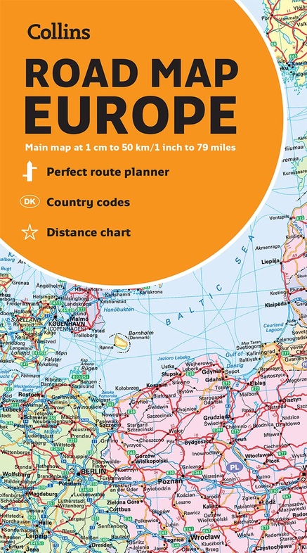
Covers the whole of Europe from the North Cape (Norway) to Gibraltar and from Ireland to east of Moscow. Also includes Iceland and Cyprus.
Key to approved country code abbreviations – GB, F, D etc.
Map key in English, French, German, Spanish and Italian
Geen items in winkelwagen
Ga naar winkelwagen
Wegenkaart - landkaart Europe road map | Collins (9780008403973)
- ISBN / CODE: 9780008403973
- Editie: 17-03-2022
- Aantal blz.: 1
- Schaal: 1:500000
- Uitgever: Collins
- Soort: Wegenkaart
- Taal: Engels
- Hoogte: 14.0 cm
- Breedte: 9.0 cm
- Gewicht: 133.0 g
- Uitvoering: Papier
- Bindwijze: -
- Schrijf als eerste een review
-
€ 10,95
Uitverkocht, nooit meer leverbaar
Beschrijving
Van de uitgever
A fully revised and updated colour road map of Europe at a scale of 79 miles to 1 inch / 50km to 1cm (1: 5,000,000). Roads, motorways, European Route numbers, railways, airports, cities and towns are clearly shown, making the map ideal for route-finding and planning journeys.Main features
Fully revised and updated
Full index to place names (on reverse of sheet)
Distance chart giving distances in kilometres between main towns
European Union map showing member states and the Eurozone
Internet links to further information on Europe
Area of coverage
Covers the whole of Europe from the North Cape (Norway) to Gibraltar and from Ireland to east of Moscow. Also includes Iceland and Cyprus.
Key to approved country code abbreviations – GB, F, D etc.
Map key in English, French, German, Spanish and Italian
Reviews
Geen reviews gevonden voor dit product.
Schrijf een review
Graag horen wij wat u van dit artikel vindt. Vindt u het goed, leuk, mooi, slecht, lelijk, onbruikbaar of erg handig: schrijf gerust alles op! Het is niet alleen leuk om te doen maar u informeert andere klanten er ook nog mee!
Alle gerelateerde rubrieken >
Ook interessant voor europa
-

Fotoboek National Parks of Europe |
€ 28,95Fotoboeken Europa -

Wegenkaart - landkaart Europa politi
€ 14,95Wegenkaarten Europa -

Woordenboek Phrasebook & Dictionary
€ 9,50Woordenboeken & Taalgidsen Europa -

Wandkaart 58 Das Große Europa Panora
€ 28,95Wandkaarten van continenten Europa -

Reisgids - Treinreisgids Perron Euro
€ 29,50Reisgidsen Europa