Categorieën
- Nieuwe artikelen
- Boeken
-
Kaarten
- Camperkaarten
- Educatieve kaarten
- Fietskaarten
- Fietsknooppuntenkaarten
- Historische Kaarten
- Pelgrimsroutes (kaarten)
- Spoorwegenkaarten
- Stadsplattegronden
- Toerskikaarten
- Topografische kaarten
- Wandelatlassen
- Wandelkaarten
- Wandelknooppuntenkaarten
- Waterkaarten
- Wegenatlassen
-
Wegenkaarten
- Afrika
- Azië
-
Europa
- Albanië
- Andorra
- Armenië
- Azerbeidzjan
- Belarus - Witrusland
- België
- Bosnië - Hercegovina
- Bulgarije
- Cyprus
- Denemarken
- Duitsland
- Engeland
- Estland
- Faroer
- Finland
- Frankrijk
- Georgië
- Griekenland
- Groenland
- Hongarije
- IJsland
- Ierland
- Italië
- Kosovo
- Kroatië
- Letland
- Liechtenstein
- Litouwen
- Luxemburg
- Malta
- Moldavië
- Monaco
- Montenegro
- Nederland
- Noord-Ierland
- Noord-Macedonië
- Noorwegen
- Oekraïne
- Oostenrijk
- Polen
- Portugal
- Roemenië
- Rusland
- Scandinavië
- Schotland
- Servië
- Slovenië
- Slowakije
- Spanje
- Tsjechië
- Turkije
- Vaticaanstad
- Zweden
- Zwitserland
- Midden-Amerika
- Midden-Oosten
- Noord-Amerika
- Oceanië
- Wereld
- Zuid-Amerika
- Wintersportkaarten
- Opruiming
- Puzzels
- Travel Gadgets
- Wandkaarten
- Wereldbollen
Veilig online betalen
Betaal veilig via uw eigen bankomgeving
- U bent hier:
- Home
- Europa
- België
- Kaarten
- Wegenkaarten
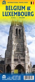
Wegenkaart - landkaart Belgium & Luxembourg - België / Luxemburg | ITMB (9781771290814)
- ISBN / CODE: 9781771290814
- Editie: 01-10-2016
- Druk: 1
- Aantal blz.: 1
- Schaal: 1:250000
- Uitgever: ITMB
- Soort: Wegenkaart
- Taal: Engels
- Hoogte: 25.0 cm
- Breedte: 10.0 cm
- Gewicht: 53.0 g
- Uitvoering: Papier
- Bindwijze: -
- Schrijf als eerste een review
-
€ 14,50
Leverbaar in 3 - 5 werkdagen in huis in Belgie Levertijd Nederland Leverbaar in 3 - 5 werkdagen in huis in Nederland Levertijd Belgie
Gratis verzending in Nederland vanaf €35,-
- Afbeeldingen
- Inkijkexemplaar
Beschrijving
Van de uitgever
Wegenkaart van België en Luxembourg
Belgium consists of two nation states, the Belge (speaking French) and the Flems (speaking Flemish). The two nations co-exist without particularly liking each other, but both agree that Belgium is one of the nicest countries in Europe. Luxembourg gets tacked on to this map simply because it is nestled into a corner of Belgium and the map would look funny if it were omitted. The Lux (I'll bet no one calls them that!) are much more 'French' in their speech and customs. I like both countries. Belgium has marvelous historic sites, such as the central market square of Brussels, the historic university town of Leuven, and the grand cathedral at Liege (called, with map is divided into west half (coast to Leuven and Breda south to Charleroi) and east half (Brussels to Aachen and Eindhoven south to the French border with Luxembourg). The map is divided into west half (coast to Leuven and Breda south to Charleroi) and east half (Brussels to Aachen and Eindhoven south to the French border with Luxembourg. Considering the small size of the entities being mapped, we were able to provide a lot of road information as well as town names, parks, camping areas, even some hotels outside of major urban areas and, of course, places of touristic interest. Luxembourg is more hilly and the Ardennes are a treat to drive through. Bastogne has a major museum dedicated to the WW2 Battle of the Bulge.
Reviews
Geen reviews gevonden voor dit product.
Schrijf een review
Graag horen wij wat u van dit artikel vindt. Vindt u het goed, leuk, mooi, slecht, lelijk, onbruikbaar of erg handig: schrijf gerust alles op! Het is niet alleen leuk om te doen maar u informeert andere klanten er ook nog mee!
Ook interessant voor europa/belgie
-

Wegenkaart - landkaart Autokaart Cla
€ 9,99Wegenkaarten België -

Campinggids Benelux 2025 | ACSI
€ 21,95Campinggidsen België -

Reisgids Capitool Reisgidsen België
€ 29,99Reisgidsen België -

Wandelgids - Wandelkaart CT15 CT LUX
€ 10,95Wandelgidsen ♦ Luxemburg BE (Provincie) -

ANWB Knooppunter kastje | ANWB Media
€ 13,99Kaartentassen België


