Categorieën
- Nieuwe artikelen
- Boeken
-
Kaarten
- Camperkaarten
- Educatieve kaarten
- Fietskaarten
- Fietsknooppuntenkaarten
- Historische Kaarten
- Pelgrimsroutes (kaarten)
- Spoorwegenkaarten
- Stadsplattegronden
- Toerskikaarten
- Topografische kaarten
- Wandelatlassen
- Wandelkaarten
- Wandelknooppuntenkaarten
- Waterkaarten
- Wegenatlassen
-
Wegenkaarten
-
Afrika
- Algerije
- Angola
- Ascension
- Benin
- Botswana
- Burkina Faso
- Burundi
- Centraal Afrikaanse Republiek
- Demokratische Republiek Kongo
- Djibouti
- Egypte
- Eritrea
- Ethiopië
- Gabon
- Gambia
- Ghana
- Guinee
- Guinee - Bissau
- Ivoorkust
- Kaapverdische eilanden
- Kameroen
- Kenia
- Kongo
- Lesotho
- Liberia
- Libië
- Madagascar
- Malawi
- Mali
- Marokko
- Mauretanië
- Mauritius
- Mozambique
- Namibië
- Niger
- Nigeria
- Oeganda
- Reunion
- Rwanda
- Senegal
- Seychellen
- Sierra Leone
- Sint Helena
- Somalië
- Sudan
- Swaziland
- Tanzania
- Togo
- Tristan da Cunha
- Tsjaad
- Tunesië
- Zambia
- Zimbabwe
- Zuid-Afrika
- Azië
- Europa
- Midden-Amerika
- Midden-Oosten
- Noord-Amerika
- Oceanië
- Wereld
- Zuid-Amerika
-
Afrika
- Wintersportkaarten
- Opruiming
- Puzzels
- Travel Gadgets
- Wandkaarten
- Wereldbollen
Veilig online betalen
Betaal veilig via uw eigen bankomgeving
- U bent hier:
- Home
- Afrika
- Zuid-Afrika
- Kaarten
- Wegenkaarten
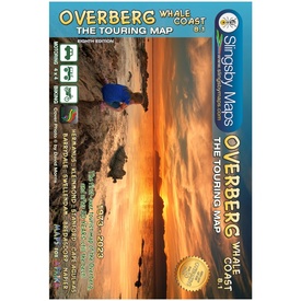
Wegenkaart - landkaart South Africa: Overberg Whale Coast | Slingsby Maps (9781920377533)
- ISBN / CODE: 9781920377533
- Editie: 01-05-2023
- Druk: 8
- Aantal blz.: 1
- Schaal: 1:250000
- Uitgever: Slingsby Maps
- Soort: Wegenkaart
- Taal: Engels
- Hoogte: 22.0 cm
- Breedte: 15.0 cm
- Dikte: 0.5 cm
- Gewicht: 91.0 g
- Uitvoering: Scheur- en watervast
- Bindwijze: -
- Schrijf als eerste een review
-
€ 29,95
Leverbaar in 3 - 5 werkdagen in huis in Belgie Levertijd Nederland Leverbaar in 3 - 5 werkdagen in huis in Nederland Levertijd Belgie
Gratis verzending in Nederland vanaf €35,-
- Afbeeldingen
- Inkijkexemplaar
Beschrijving
Reviews
Geen reviews gevonden voor dit product.
Schrijf een review
Graag horen wij wat u van dit artikel vindt. Vindt u het goed, leuk, mooi, slecht, lelijk, onbruikbaar of erg handig: schrijf gerust alles op! Het is niet alleen leuk om te doen maar u informeert andere klanten er ook nog mee!
Ook interessant voor afrika/zuid-afrika
-

Wegenatlas - Reisgids Garden Route &
€ 14,50Reisgidsen Zuid-Afrika -

Wegenkaart - landkaart 10 Western Ca
€ 16,95Wegenkaarten Zuid-Afrika -

Campinggids - Campergids Camp and Ca
€ 32,95Campergidsen Zuid-Afrika -

Vogelgids Birds of South Africa - Zu
€ 24,95Vogelgidsen Zuid-Afrika -

Wandelgids Südafrika West | Rother B
€ 21,50Wandelgidsen Zuid-Afrika


